95 Counties · 1,002 Public Access Points · 78 Lakes and RiversTennessee state record fish

East Tennessee · County seat Kingston

Fishing in Roane County, Tennessee

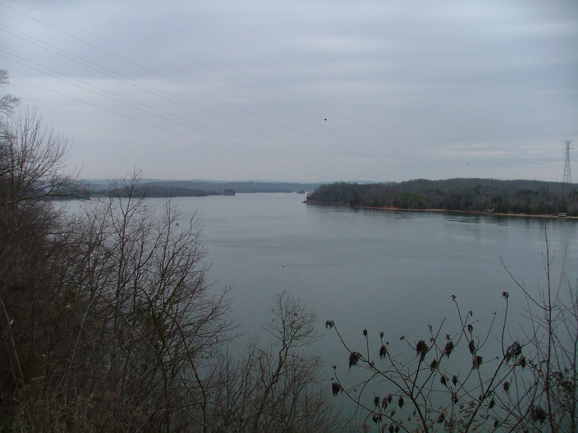
Watts Bar Lake, Clinch River, Emory River. Where to launch, where to fish from the bank, and where to buy what you forgot.

Every public access point

Fishing access in Roane County

36 public access points in Roane County: 31 boat launches, 5 fishing piers, 1 designated fishing site and 4 marinas. Each one opens its own page with written directions, coordinates and a link straight to Google Maps.

Tap a pin for the spot page and directions. Open the full Tennessee fishing map.

Watts Bar Lake 33 in Roane County

Free4.5 out of 5facilitiesBoat Launch · CityLadd Landing4 ramps, More Than 3 lanesfishing piercanoe / kayak landingrestroomsDirections and detail →35.88570, -84.49190Free5 out of 5facilitiesBoat Launch · TVASwan Pond2 ramps, 2 lanesfishing piercanoe / kayak landingrestroomsaccessible parkingDirections and detail →35.91702, -84.50411Free5 out of 5facilitiesBoat Launch · CityTom Fuller RampHwy 27 to Nelson St. Take Nelson St. to Pumphouse and go approx. 0.5 miles, ramp on right2 ramps, 2 lanesfishing piercanoe / kayak landingrestroomsDirections and detail →35.83415, -84.68643Free3.5 out of 5facilitiesBoat Launch · TWRABell Cove1 ramp, 1 lanecanoe / kayak landingDirections and detail →35.84370, -84.53200Free4.5 out of 5facilitiesBoat Launch · TWRABlue Springs MarinaHwy 58 South, turn right on 304, go approx. 7 miles, Marina on right2 ramps, 2 lanesrestroomsDirections and detail →35.73520, -84.66780Free2 out of 5facilitiesBoat Launch · TWRABrowns ChapelFrom Kingston, go west on HWY 70 to Caney Creek Rd, turn left then approximately 3 miles to ramp on left1 ramp, 1 lanecanoe / kayak landingDirections and detail →35.83560, -84.62480Free3.5 out of 5facilitiesBoat Launch · CountyCaney Creek4 ramps, More Than 3 lanescanoe / kayak landingaccessible parkingDirections and detail →35.85513, -84.60092Free2.5 out of 5facilitiesBoat Launch · TWRADe Armond1.5 miles off highway 304(River Rd)1 ramp, 1 lanecanoe / kayak landingDirections and detail →35.83784, -84.59150Free4.5 out of 5facilitiesBoat Launch · CityGravel PitHwy 70 approx. 0.5 miles west of Kingston1 ramp, 2 lanescanoe / kayak landingrestroomsaccessible parkingDirections and detail →35.87694, -84.52268Free2.5 out of 5facilitiesBoat Launch · TWRAHog Back RidgeHWY 27 South from Rockwood, left on Abels Valley Road, right on Winton Chapel Road, follow to ramp on right1 ramp, 1 lanecanoe / kayak landingDirections and detail →35.76130, -84.70010Free3 out of 5facilitiesBoat Launch · TWRAJohnson CreekHWY 70 East from Kingston, turn right on Paint Rock Ferry Road to ramp on right1 ramp, 1 lanecanoe / kayak landingDirections and detail →35.82230, -84.48490Free5 out of 5facilitiesBoat Launch · CityKingston City ParkHwy 70 approx 0.5 miles west of Kingston1 ramp, 2 lanescanoe / kayak landingrestroomsaccessible parkingDirections and detail →35.87750, -84.52420Free3 out of 5facilitiesBoat Launch · TVAKingston Steam Plant1 ramp, 2 lanesDirections and detail →35.89525, -84.52319Free2.5 out of 5facilitiesBoat Launch · TWRALakewood1 ramp, 1 lanecanoe / kayak landingDirections and detail →35.88921, -84.52345Free2 out of 5facilitiesBoat Launch · TWRALaurel BluffOff Broken Arrow Point Road1 ramp, 1 lanecanoe / kayak landingDirections and detail →35.79949, -84.51005Free2.5 out of 5facilitiesBoat Launch · TWRALittle DogwoodOff Little Dogwood Road1 ramp, 1 lanecanoe / kayak landingDirections and detail →35.77720, -84.43920Free3.5 out of 5facilitiesBoat Launch · TWRALittle Emory1 ramp, 1 laneaccessible parkingDirections and detail →35.95830, -84.47940Free3.5 out of 5facilitiesMarina · Private LandLong Island MarinaOff Paint Rock Ferry Road1 ramp, 1 lanecanoe / kayak landingrestroomsDirections and detail →35.83380, -84.49340Free3.5 out of 5facilitiesBoat Launch · TVAMelton Hill Dam (Downstream)Off highway 95 at the bridge2 ramps, 2 lanescanoe / kayak landingDirections and detail →35.88780, -84.32299Free3 out of 5facilitiesBoat Launch · TWRAMoonlight BayOff New Hope Road1 ramp, 1 lanecanoe / kayak landingaccessible parkingDirections and detail →35.82240, -84.65410Free2 out of 5facilitiesBoat Launch · TWRAMourneys CoveOff Morning Cove Road1 ramp, 1 lanecanoe / kayak landingDirections and detail →35.83370, -84.53520Free2 out of 5facilitiesBoat Launch · TWRAOld Kingston Rd1 ramp, 1 lanecanoe / kayak landingDirections and detail →35.78184, -84.38849Launch fee4.5 out of 5facilitiesBoat Launch · CountyRiley CreekHwy 58 south, turn left on Hood Landing Rd., Go to stop sign, turn left on Walnut Grove, then right2 ramps, 2 lanescanoe / kayak landingrestroomsDirections and detail →35.82860, -84.52830Free2.5 out of 5facilitiesBoat Launch · TWRARockwood BeachRight next to Tim Fuller Access Area1 ramp, 1 lanecanoe / kayak landingDirections and detail →35.83423, -84.69060Free2 out of 5facilitiesBoat Launch · TWRARockwood FerryHWY 70 to Caney Creek Road, then left on Old Rockwood Landing Road, dead ends at ramp1 ramp, 1 lanecanoe / kayak landingDirections and detail →35.78790, -84.64360Free3.5 out of 5facilitiesBoat Launch · TWRAShady GroveOff HWY 3041 ramp, 1 lanecanoe / kayak landingaccessible parkingDirections and detail →35.77400, -84.62010Free2 out of 5facilitiesBoat Launch · TWRASugar TreeOff Emory River Road1 ramp, 1 lanecanoe / kayak landingDirections and detail →35.90312, -84.48021Free2 out of 5facilitiesBoat Launch · TVAWhitestone1 ramp, 1 lanecanoe / kayak landingDirections and detail →35.79129, -84.49233Free3.5 out of 5facilitiesBoat Launch · TWRAWinton ChapelTake 27 south of Rockwood. Turn left onto Abels Valley Rd, then right on Winton Chapel1 ramp, 1 lanecanoe / kayak landingaccessible parkingDirections and detail →35.79134, -84.69090Fee not listed3 out of 5facilitiesMarina · MarinaBayside MarinaHwy 58 South, turn right onto 304, go approx. 6miles, Marina on rightfishing pierrestroomsDirections and detail →35.75020, -84.65870Fee not listed3.5 out of 5facilitiesMarina · CityRockwood Marina & RV ParkNext to Tom Fuller Access Areafishing pierrestroomsaccessible parkingDirections and detail →35.83486, -84.67949Launch fee3.5 out of 5facilitiesMarina · MarinaCaney Creek Marinarestroomsrentalsaccessible parkingDirections and detail →35.87029, -84.60320Fee not listed2 out of 5facilitiesFishing Site · CountyLakewood Fishing AccessOff highway 70 just under the bridge leaving Kingstoncanoe / kayak landingDirections and detail →35.88794, -84.52390

Clinch River 2 in Roane County

Emory River 1 in Roane County

What to bring

What to bring fishing in Roane County

Three picks from the smallmouth bass checklist that work for the fish here. Affiliate links: buying through them pays this site a small commission at no extra cost to you.

RodSt. Croix Bass X 7 ft medium spinning rodLight enough for a Ned rig, with enough backbone for a 5 lb fish in current.Shop on Amazon →Why it is on the list
ReelPflueger President 30 spinning reelSmooth drag at a fair price. Fill it with braid and a leader.Shop on Amazon →Why it is on the list
FinesseZ-Man Finesse TRD and Ned rig jigheadsThe single most reliable smallmouth bait on Tennessee rock. Drag it slowly.Shop on Amazon →Why it is on the list

Spending more? The bigger purchases, compared side by side:

Roane County at a glance

Roane County boat ramps and fishing access

Roane County has 36 public fishing access points: 31 boat ramps, 5 fishing piers and 4 marinas, on 3 lakes, rivers and creeks.

31boat ramps
5fishing piers
4marinas
3lakes, rivers and creeks

The big water in Roane

Main fishing waters in Roane County

What each of these is actually known for, and what you can expect to catch.

TVA reservoir · ~39,000–39,600 acres, 722 mi shoreline including the Clinch and Emory arms ·…

Watts Bar Lake

Most of Roane County’s river mileage is Watts Bar. Its three arms, Tennessee, Clinch and Emory, fish as three separate lakes, which is the single most useful thing to tell an angler about it. TVA rates it at or near the top of its system for crappie and black bass; Florida-strain largemouth have been stocked since 2015 and walleye since 2011.

crappielargemouth and spotted basssmallmouthcatfish
river / reservoir arm · not verified · TVA below Melton Hill, TWRA fishery

Clinch River

Enters the county from the north and joins the Tennessee just downstream of Kingston; the Roane reach is reservoir-influenced rather than the cold trophy-brown tailwater, which is upstream in Anderson County below Norris Dam.

smallmouthsaugerstriped basscatfish
river / reservoir arm · ~46 mi overall · TWRA fishery

Emory River

The Emory joins the Clinch near Kingston and its lower reach is the county’s distinctive fishery: a winter and early-spring sauger run that carries its own gear restriction, which is the thing to build the page around.

saugerwalleyesmallmouthcatfish

No boat, or your own boat

Bank fishing and launching in Roane County

Fishing from the bank in Roane County

Kingston city waterfront and Fort Southwest Point; the Emory River bridges at Harriman and Oakdale, which are the practical sauger-run bank spots; Swan Pond; Caney Creek and Riley Creek recreation areas; the Melton Hill Dam tailwater, where two ramps sit at the dam, one below and one above; Watts Bar Dam tailwater at the southern end; Ladd Landing.

Getting a boat on the water in Roane County

Watts Bar is fully navigable with no blanket horsepower rule, with no-wake zones around marinas, dams and recreation areas. Long Island Marina and the Caney Creek, Riley Creek, Blue Springs, Cave Creek and Stamp Creek launches serve the Roane shore.

The Emory above the reservoir influence is canoe and jon-boat water. The Clinch arm is a distinct run with its own character. Paddling on the upper Emory and Obed system is whitewater rather than fishing water.

Two different trips

Visiting Roane County versus fishing it like a local

Where visitors get pointed in Roane County

Kingston’s Fort Southwest Point; Watts Bar Lake as a whole; the Obed Wild and Scenic River, just north in Morgan County; Roane County’s Watts Bar recreation areas and campgrounds; Harriman’s historic district; Oak Ridge and the Melton Hill rowing course just over the Anderson line.

Where Roane County locals actually go

The Emory between Harriman and Oakdale during the January–April sauger run, locals fish it hard, it is regulated specifically because of that, and almost no visiting angler knows it exists. The Whites Creek embayment on the Rhea line. The Little Emory. Swan Pond. The Clinch arm above Kingston, which fishes quite differently from the Tennessee River arm and gets a fraction of the traffic.

The Melton Hill tailwater, where the two-ramp arrangement at the dam lets you fish either reservoir from the same parking area.

Rules and record fish

Limits and records for Roane County water

Creel and length limits in Roane County

The Emory River rule is the county’s headline and should be stated precisely. From 1 January–30 April, on the Emory River from the Highway 27 bridge at Harriman upstream to the Highway 299 bridge at Oakdale, anglers are restricted to one hook with a single point, or one lure with a single hook with one point, and to a maximum of three rods, reels or poles.

Separately and year-round, the Emory is closed to snagging, taking or possession of paddlefish or any parts thereof from the mouth of the Emory upstream to the Highway 299 bridge at Oakdale. On Watts Bar generally, paddlefish are 1 per day with the season open 1 May–15 May.

Melton Hill, at the county’s northern edge, carries largemouth 14-inch minimum, smallmouth 18-inch minimum, striped bass on a 32–42 inch protected range with only one over 42 inches, muskellunge 1 per day at a 50-inch minimum with unharvested fish released immediately, and paddlefish 2 per day 24 April–31 May. On the Clinch River from Norris Reservoir upstream to Grissom Island, walleye and sauger are 5 per day combined with a 15-inch minimum, that reach is upstream of Roane but anglers running the Clinch should know it.

TDEC advises everyone against eating catfish from Melton Hill (PCBs), and Watts Bar carries its own consumption advisories.

State record fish from Roane County water

Skipjack herring, 4 lb 3 oz, Watts Bar Reservoir, Marc A. Cooper II, 17 February 2015, credited to the reservoir, which spans Roane, Rhea, Meigs and Loudon counties.

31 public boat launches in Roane County, counted from TWRA’s own access database.

Questions people actually ask

Roane County fishing questions

Where can I fish from the bank in Roane County?

Kingston city waterfront and Fort Southwest Point. Also the emory river bridges at harriman and oakdale, which are the practical sauger-run bank spots, and swan pond. Roane County has 5 public fishing piers listed in TWRA’s access database.

How many public boat ramps are in Roane County?

TWRA’s access database lists 31 boat launches in Roane County, plus 4 marinas. Most of them are on Watts Bar Lake. Every one is listed further up this page with its owner and lane count.

Do I need a fishing license to fish in Roane County?

Yes. Anyone 13 and over needs a Tennessee fishing license, and there is no license required for ages 12 and under. A resident annual combination hunt and fish license is $33, a resident one-day all-species license is $11, and a non-resident three-day all-species license is $40. Tennessee has no non-resident one-day license. Buy online at gooutdoorstennessee.com, from a county clerk or from a licensed agent. Licenses are digital, nothing arrives in the post.

What fish can you catch in Roane County?

The main species across Roane County water are smallmouth bass, spotted bass, crappie, rock bass, striped bass, white bass, walleye, sauger and catfish. Each water body on the fishing spots page lists what it is actually known for, which is not always the same thing.

Does my Tennessee license cover trout in Roane County?

Not automatically. The $33 resident combination hunt and fish license does not cover trout, and neither does the county-of-residence license or the cheaper no-trout short-term options. Those need the $21 annual trout supplemental added on. The Sportsman licenses and every non-resident all-species license already include trout. There is no designated trout water in Roane County, but it is worth knowing before you drive to a tailwater elsewhere in the state.

What are the creel limits in Roane County?

The Emory River rule is the county’s headline and should be stated precisely. From 1 January–30 April, on the Emory River from the Highway 27 bridge at Harriman upstream to the Highway 299 bridge at Oakdale, anglers are restricted to one hook with a single point, or one lure with a single hook with one point, and to a maximum of three rods, reels or poles Separately and year-round, the Emory is closed to snagging, taking or possession of paddlefish or any parts thereof from the mouth of the Emory upstream to the Highway 299 bridge at Oakdale Always check the current TWRA guide before you keep anything, because water-specific exceptions change.

Where can I buy bait and tackle in Roane County?

Harriman and Kingston are the county’s retail towns and Oak Ridge is about 25 minutes north with fuller sporting goods retail. There is a fuller list on the Roane County gear page, including anywhere renting boats or kayaks and the nearest big-box store.

Where do locals fish in Roane County?

The Emory between Harriman and Oakdale during the January–April sauger run, locals fish it hard, it is regulated specifically because of that, and almost no visiting angler knows it exists. The Whites Creek embayment on the Rhea line. The Little Emory. Swan Pond. The Clinch arm above Kingston, which fishes quite differently from the Tennessee River arm and gets a fraction of the traffic. The Melton Hill tailwater, where the two-ramp arrangement at the dam lets you fish either reservoir from the same parking area.

The water itself

Lakes and rivers in Roane County

Each of these has a page of its own covering the whole water, not just the Roane County end of it, with every public access point on it and what it holds.

Roane County water holds smallmouth bass, spotted bass, crappie, rock bass.

Statewide limits: 5 black bass, 15 crappie at 10 inches, 2 stripers at 15 inches, 7 trout.

About this list

Where the Roane County access list comes from

The 36 access points above come from the Tennessee Wildlife Resources Agency’s public access database, which is why each one names the agency that owns or manages it. A state or TVA ramp is usually free. A Corps of Engineers site, a state park ramp or a marina often is not.

The waters, species and local notes are researched separately, county by county, against TWRA’s own reservoir pages, TVA, the US Army Corps of Engineers and Tennessee State Parks.

Ramps close for repairs, gravel roads wash out and regulations change. Treat anything here as a starting point and call ahead if you are driving a long way for it.

By town instead

Towns near Roane County

These pages measure from the middle of town rather than the county line, which is usually the number you actually care about.

5 public fishing piers in Roane County, no boat needed.

Keep going

More Roane County water, and who fishes it

Every guide and charter on this site is listed by the water they run, so you can call the captain direct. Licences, limits and the state record list are one click away too.

Weather alerts, power outages and road closures in Roane County right now: Roane County conditions.