95 Counties · 1,002 Public Access Points · 78 Lakes and RiversTennessee state record fish

Lake · Hamilton, Meigs and Rhea

Fishing Chickamauga Lake, Tennessee

51 public access points across 3 counties, with directions to every one.

Every access point

Public access on Chickamauga Lake, county by county

All 51 public access points TWRA records on Chickamauga Lake. Each card opens its own page with written directions, coordinates and a link straight to Google Maps.

Tap a pin for the spot page and directions. Open the full Tennessee fishing map.

Chickamauga Lake access in Hamilton County

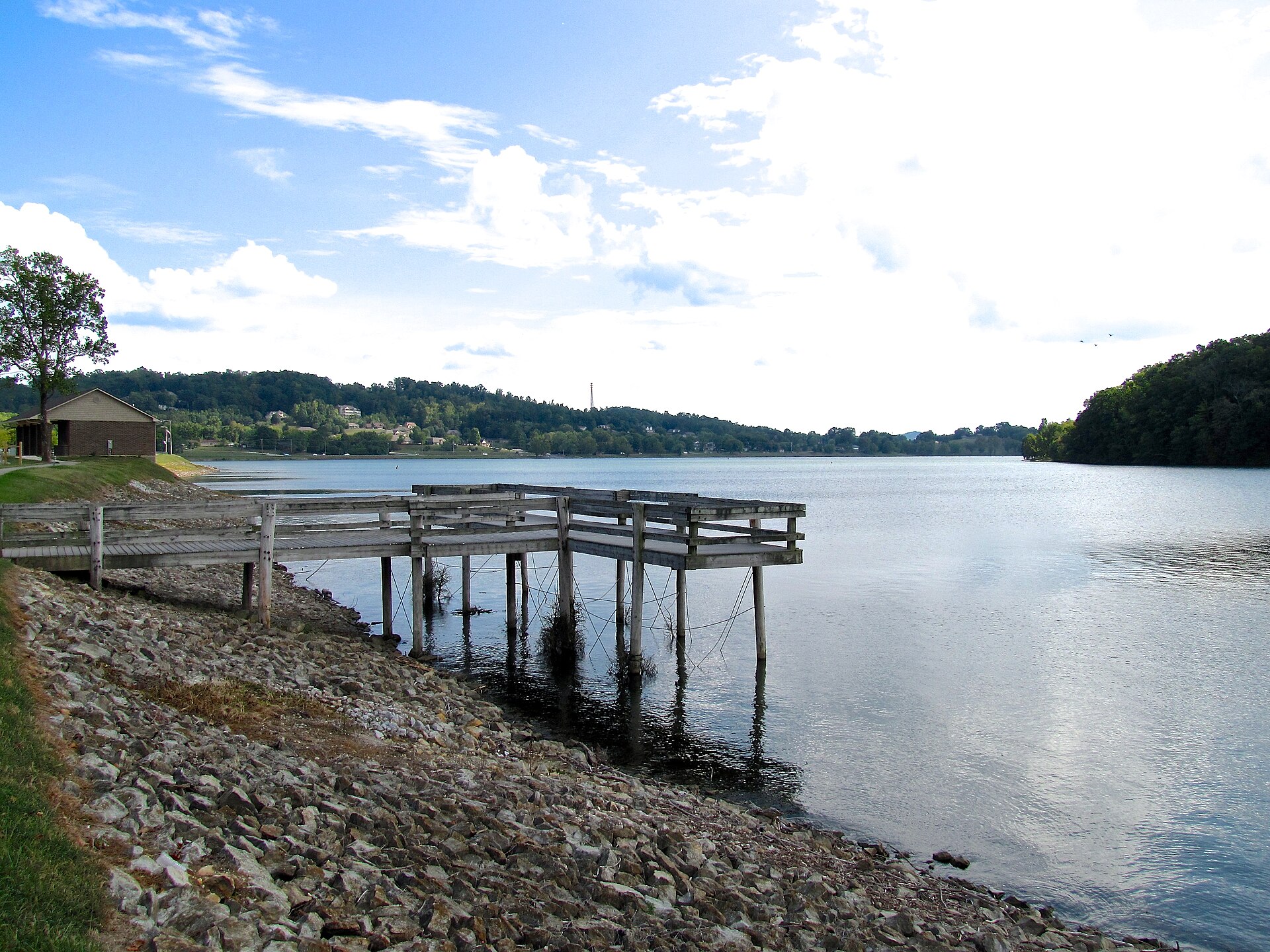
Free2.5 out of 5facilitiesBoat Launch · TWRAChickamauga Lake Boat Launch1 ramp, 1 lanecanoe / kayak landingDirections and detail →35.27470, -85.14367Free4.5 out of 5facilitiesBoat Launch · CityHolly Circle1 ramp, 2 lanescanoe / kayak landingrestroomsaccessible parkingDirections and detail →35.28388, -85.14214Free2.5 out of 5facilitiesBoat Launch · TWRAArmstrong1 ramp, 1 laneDirections and detail →35.27095, -85.12234Launch fee4.5 out of 5facilitiesBoat Launch · TDECBooker T. Washington State ParkHWY 58 to Champion Road1 ramp, 2 lanesfishing piercanoe / kayak landingrestroomsaccessible parkingDirections and detail →35.11060, -85.17980Fee not listed1 out of 5facilitiesMarinaChattanooga Yacht ClubDirections and detail →35.12247, -85.14677Free4 out of 5facilitiesBoat Launch · CountyChester Frost ParkHixson Pike to Gold Point Circle N2 ramps, More Than 3 lanesfishing piercanoe / kayak landingrestroomsaccessible parkingDirections and detail →35.18410, -85.14750Fee not listed1 out of 5facilitiesMarinaChickamauga MarinaDirections and detail →35.09439, -85.21877Free2 out of 5facilitiesBoat Launch · TWRAEldridge Slough Ramp1 ramp, 1 lanecanoe / kayak landingDirections and detail →35.30360, -85.05020Launch fee1.5 out of 5facilitiesMarina · Private LandGold Point MarinaDirections and detail →35.11330, -85.20400Launch fee4.5 out of 5facilitiesBoat Launch · TVAGrasshopper Recreation Area1 ramp, 2 lanesrestroomsaccessible parkingDirections and detail →35.37120, -85.07200Launch fee4.5 out of 5facilitiesMarina · Private LandHarbor Lights Marina, Inc.1 ramp, 1 lanefishing pierrestroomsaccessible parkingDirections and detail →35.21030, -85.11950Free2.5 out of 5facilitiesBoat Launch · TWRA/TVAHarrison1 ramp, 1 lanecanoe / kayak landingDirections and detail →35.12870, -85.13700Free5 out of 5facilitiesBoat Launch · TDECHarrison Bay State Park2 ramps, 2 lanesfishing piercanoe / kayak landingrestroomsaccessible parkingDirections and detail →35.16790, -85.12160Fee not listed1 out of 5facilitiesMarinaHarrison Bay State Park MarinaDirections and detail →35.16836, -85.12147Launch fee3.5 out of 5facilitiesMarina · Private LandHixson Marina1 ramp, 1 lanecanoe / kayak landingrestroomsDirections and detail →35.14110, -85.17460Free2.5 out of 5facilitiesBoat Launch · TWRAIles RoadHwy 27 north of Sale Creek; right on Daughert Ferry Rd; 1.75 miles to Iles Rd to ramp1 ramp, 1 laneDirections and detail →35.37710, -85.08946Free3 out of 5facilitiesMarina · MarinaIsland Cove Marina & Resortrestroomsaccessible parkingDirections and detail →35.13660, -85.12280Free2.5 out of 5facilitiesBoat Launch · TWRAIsland View-CLOSEDHWY 58 to Gamble Road, right on HWY 312, left on Thatch Road, ramp on right1 ramp, 1 laneDirections and detail →35.29211, -85.06833Free3 out of 5facilitiesMarina · MarinaLakeshore Marinarestroomsaccessible parkingDirections and detail →35.10910, -85.21620Free3 out of 5facilitiesMarina · MarinaLakesite Marina1 ramp, 1 laneDirections and detail →35.21450, -85.12650Free2.5 out of 5facilitiesBoat Launch · TWRALee Pike1 ramp, 1 laneDirections and detail →35.35625, -85.06325Free2.5 out of 5facilitiesBoat Launch · TWRAPattersonS HWY 27 left on Patterson Road, left at Patterson Cemetery, ramp on left1 ramp, 1 laneDirections and detail →35.37700, -85.09074Free2.5 out of 5facilitiesBoat Launch · TWRAPecan Point1 ramp, 2 lanescanoe / kayak landingDirections and detail →35.14060, -85.16290Free3.5 out of 5facilitiesMarina · MarinaPine Harbor Marina1 ramp, 1 lanerestroomsDirections and detail →35.27620, -85.13110Launch fee4.5 out of 5facilitiesBoat Launch · TVAPossom Creek Recreation Area1 ramp, 2 lanescanoe / kayak landingrestroomsaccessible parkingDirections and detail →35.29980, -85.08860Launch fee3 out of 5facilitiesMarina · MarinaSale Creek Marina1 ramp, 1 lanerestroomsDirections and detail →35.35810, -85.06000Free2.5 out of 5facilitiesBoat Launch · TWRASavannah BayS HWY 58 to HWY 312, right on Snow Hill Road, ramp on left1 ramp, 1 laneDirections and detail →35.15737, -85.06010Launch fee2 out of 5facilitiesFishing Site · Private LandShady GroveDirections and detail →35.26620, -85.11910Fee not listed1 out of 5facilitiesMarinaShady Grove HarborDirections and detail →35.26521, -85.11919Free3.5 out of 5facilitiesBoat Launch · TVASkull Island Ramp1 ramp, 1 lanefishing pieraccessible parkingDirections and detail →35.23976, -85.07121Free2.5 out of 5facilitiesBoat Launch · TWRATyner Boat Ramp1 ramp, 1 lanecanoe / kayak landingDirections and detail →35.12120, -85.14350Free2.5 out of 5facilitiesBoat Launch · TWRA/TVAVincent Road Ramp-CLOSED1 ramp, 1 lanecanoe / kayak landingDirections and detail →35.13300, -85.16170Free2.5 out of 5facilitiesBoat Launch · TWRAWare Branch1 ramp, 1 laneDirections and detail →35.26256, -85.07919Free5 out of 5facilitiesBoat Launch · TDECWolftever Bridge1 ramp, 3 lanesfishing piercanoe / kayak landingrestroomsaccessible parkingDirections and detail →35.15020, -85.10800

Chickamauga Lake access in Meigs County

Fee not listed1.5 out of 5facilitiesMarinaAgency Creek Campground Marina1 rampDirections and detail →35.37439, -84.90696Free2.5 out of 5facilitiesBoat Launch · TWRABear BranchHwy 60 north from Birchwood approx 2.25 miles to Burton Rd, left to Shahan Rd, approx..5 miles to ramp on right1 ramp, 1 laneDirections and detail →35.38249, -85.01522Free3 out of 5facilitiesBoat Launch · CountyBlythes Ferry / Meigs County1 ramp, 2 lanesDirections and detail →35.40936, -85.00866Free3 out of 5facilitiesBoat Launch · TWRAGoodfield CreekHwy 30 west 2.75 miles from Decatur; turn left on Cottonport Rd, ramp is 1.5 miles on right across bridge.1 ramp, 2 lanesDirections and detail →35.49740, -84.85270Free4 out of 5facilitiesBoat Launch · CountyHwy 58 BridgeSouth of Hwy 58 bridge in Meigs County1 ramp, 2 lanesaccessible parkingDirections and detail →35.35988, -84.91281Free1.5 out of 5facilitiesFishing Site · TWRAHwy 58 Bridge NorthDirections and detail →35.36920, -84.90939Free3.5 out of 5facilitiesBoat Launch · TVAPinhook1 ramp, 1 laneaccessible parkingDirections and detail →35.60512, -84.77424Free2.5 out of 5facilitiesBoat Launch · TWRAPrice’s Creek EastHwy 58 to Lamontville Rd; approx. 4.5 miles to ramp1 ramp, 1 laneDirections and detail →35.35929, -84.86027Free2.5 out of 5facilitiesBoat Launch · TWRASewee CreekHwy 68 east of Watts Bar Dam to Hwy 304 south approx. 4 miles to Hornsby Rd; ramp on left1 ramp, 1 laneDirections and detail →35.58011, -84.79366Free1.5 out of 5facilitiesFishing Site · TVAWatts Bar DamDirections and detail →35.62062, -84.77736Free1.5 out of 5facilitiesFishing Site · TVAPrice’s Creek WestHwy 58 to Lamontville Rd approx. 4.5 miles; before bridge on rightDirections and detail →35.36227, -84.86250

Chickamauga Lake access in Rhea County

What to bring

Tackle for Chickamauga Lake

Three picks from the largemouth bass checklist that work for the fish here. Affiliate links: buying through them pays this site a small commission at no extra cost to you.

RodUgly Stik GX2 7 ft medium-heavy casting rodStiff enough to set a hook in grass, tough enough to live in a truck bed.Shop on Amazon →Why it is on the list
ReelAbu Garcia Black Max baitcasting reelAn inexpensive baitcaster that casts cleanly once the brakes are set.Shop on Amazon →Why it is on the list
Soft plasticZoom Trick WormThe Tennessee standard on a Texas rig or weightless along docks and grass edges.Shop on Amazon →Why it is on the list

Spending more? The bigger purchases, compared side by side:

The water

Chickamauga Lake boat ramps and fishing access

Chickamauga Lake has 51 public access points: 40 boat ramps, 9 fishing piers and 14 kayak launches, in Hamilton, Meigs and Rhea counties.

51public access points
40boat ramps
9fishing piers
14kayak and canoe launches
3counties

Lake conditions

Chickamauga Lake level today

TVA’s current Chickamauga Lake level, the 24-hour change, the Chickamauga Dam generation schedule and the level forecast, on one page.

What Chickamauga Lake is actually like

Chickamauga Lake, county by county

Chickamauga Lake does not fish the same at both ends. This is what the research for each county on it turned up.

Meigs County

From the Meigs County page

Meigs County holds the mid-lake water where the reservoir slows into sloughs and embayments; TWRA’s stocking programme lifted average angler catch weight from 1.42 lb to consistently over 3 lb, and crappie surveys average 2.85 fish per hour at 0.76–0.80 lb.

Rhea County

From the Rhea County page

Dayton is the standard launch town for Chickamauga and the lake’s reputation as a big-bass water rests on Florida-strain largemouth stocked since 2000, which lifted average angler catch weight from about 1.4 lb to consistently over 3 lb.

Hamilton County

From the Hamilton County page

TWRA has stocked Florida-strain largemouth since 2000 and average angler catch weight rose from 1.42 lb to consistently over 3 lb, which is why the lake became a national big-bass destination.

What you can catch

Fish in Chickamauga Lake

What Chickamauga Lake actually holds, from the county research behind this site and TWRA’s own species notes. A licence is required for all of it.

What you can keep

Fishing limits on Chickamauga Lake

TWRA sets 3 rules just for Chickamauga Lake. They replace the statewide limit for those fish. Everything else follows the statewide limit.

FishDaily limitLengthWhere or when
Largemouth bass5 black bass combined15 in minimumChickamauga Lake rule
Smallmouth bass5 black bass combinedNo minimum, only one over 16 inSame rule covers spotted, Alabama and hybrid bass: only one of these over 16 in per day
Spotted bass5 black bass combinedNo minimum, only one over 16 inIncludes Alabama bass and hybrids
Crappie1510 in minimumStatewide
BluegillNo limitNo minimumStatewide
Redear sunfish20No minimumStatewide
Striped bass2 striped and hybrid combined15 in minimumStatewide
Walleye516 in minimumStatewide
Sauger1015 in minimumStatewide

Other rules on Chickamauga Lake

  • Hiwassee Refuge closed to all use Nov 15–end of Feb except the wildlife viewing area; fishing allowed on the main river channel through the refuge.

From the 2026–27 Tennessee Fishing Guide (TWRA), in effect 1 August 2026 to 31 July 2027, checked 25 September 2026. Rules change, so check the guide before you keep a fish.

Tournaments

Upcoming tournaments on Chickamauga Lake

Nov212026

Hamilton County Hookers

Nov 21, 2026 · Club (Tennessee BASS Nation)

Launch: Holly Circle

Event page

Feb132027

Phoenix Bass Fishing League Team/Solo

Feb 13, 2027 · Major League Fishing

Launch: Highway 30 Ramp (Fish Dayton North), Dayton

Event page

Mar52027

Tackle Warehouse Pro Circuit

Mar 5–7, 2027 · Major League Fishing

Launch: Chester Frost Park, Hixson

Event page

May142027

Big Bass Tour: Chickamauga Lake

May 14–16, 2027 · Big Bass Tour

Event page

May222027

Phoenix Bass Fishing League Team/Solo

May 22, 2027 · Major League Fishing

Launch: Highway 30 Ramp, Dayton

Event page

51 public access points on Chickamauga Lake, every one with directions.

Common questions

Questions about fishing Chickamauga Lake

How many public boat ramps are there on Chickamauga Lake?

TWRA lists 40 public boat launches on Chickamauga Lake, with 49 ramp lanes between them, across 3 Tennessee counties. Every one of them is listed on this page with directions.

What fish can you catch in Chickamauga Lake?

Chickamauga Lake holds largemouth bass, smallmouth bass, spotted bass, crappie, bluegill, redear sunfish, striped bass, walleye and sauger. Which of those is actually worth chasing depends on the season, and TWRA sets size and creel limits that change, so check before you keep anything.

Which counties does Chickamauga Lake run through?

Hamilton, Meigs and Rhea counties. Each has its own page on this site with the local bait shops, ramps and bank access.

Can you fish Chickamauga Lake from the bank?

Yes. 9 of the public access points on Chickamauga Lake have a built fishing pier, and most of the ramps have shoreline you can walk. A pier is the easiest option with children or without a boat.

Do you need a licence to fish Chickamauga Lake?

Yes. Anyone 13 or older needs a Tennessee fishing licence, and a trout supplemental on top if you plan to keep trout. Non-residents can buy a three-day or ten-day licence rather than a full year.

Is Chickamauga Lake free to fish?

The water is. Some of the ramps are not, Corps of Engineers sites, state park ramps and marinas often charge to launch or park. Each listing below shows the owner, which is the best guide to whether you will be asked for money.

Keep going

More Chickamauga Lake water, and who fishes it

Every guide and charter on this site is listed by the water they run, so you can call the captain direct. Licences, limits and the state record list are one click away too.

Before you launch, check today's level, dam release schedule and any weather alerts for Chickamauga Lake: Chickamauga Lake conditions.