95 Counties · 1,002 Public Access Points · 78 Lakes and RiversTennessee state record fish

West Tennessee · County seat Dyersburg

Fishing in Dyer County, Tennessee

Dyer County is thin on public water. This page lists what there is, then points at what is close.

What to bring

What to bring fishing in Dyer County

Three picks from the largemouth bass checklist that work for the fish here. Affiliate links: buying through them pays this site a small commission at no extra cost to you.

RodUgly Stik GX2 7 ft medium-heavy casting rodStiff enough to set a hook in grass, tough enough to live in a truck bed.Shop on Amazon →Why it is on the list
ReelAbu Garcia Black Max baitcasting reelAn inexpensive baitcaster that casts cleanly once the brakes are set.Shop on Amazon →Why it is on the list
Soft plasticZoom Trick WormThe Tennessee standard on a Texas rig or weightless along docks and grass edges.Shop on Amazon →Why it is on the list

Spending more? The bigger purchases, compared side by side:

Dyer County at a glance

Dyer County boat ramps and fishing access

Dyer County has 7 public fishing access points: 7 boat ramps, on 5 lakes, rivers and creeks.

7boat ramps
5lakes, rivers and creeks

The big water in Dyer

Main fishing waters in Dyer County

What each of these is actually known for, and what you can expect to catch.

river · US Army Corps of Engineers (navigation); TWRA manages the fishery

Mississippi River

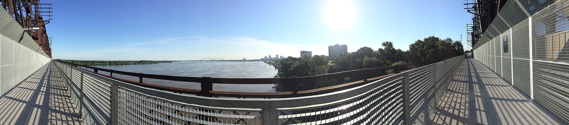
Dyer County fronts the Mississippi at Heloise, the county’s sole river village, and carries the only highway bridge over the Mississippi between Cairo, Illinois and Memphis

blue catfishflathead catfishchannel catfishbuffalo
rivers · TWRA

Obion River and North Fork Forked Deer River

The two main interior drainages; both are slow, turbid bottomland rivers with good catfish and, in the oxbows and sloughs, surprisingly good crappie.

catfishcrappielargemouthbowfin

The ones nobody writes about

Small and out-of-the-way water in Dyer County

County lakes, park ponds, creeks and river stretches in Dyer County that never make a best-of list. Several of them fish better than the famous water on a busy weekend.

WMA wetlands, sloughs and open water · 5,119 acres of WMA

Moss Island WMA waters

About 23 miles west of Dyersburg and six miles south of Highway 20 along the Mississippi River levee, this is the county’s largest public land holding on water

catfishbowfingar
urban river park

Forked Deer River Park, Dyersburg

A few blocks from the downtown square, with a kayak launch, a levee walking path and a wooded riverside trail; built with a $7.4 million National Disaster Resiliency Grant, groundbreaking June 2019.

catfishsunfish
river

South Fork Forked Deer River

Runs through the southern part of the county.

catfishcrappiebowfin
small natural/artificial lakes

Oxbow lakes and borrow pits along the Mississippi levee

These are the classic West Tennessee hidden waters, but ownership is genuinely mixed and most require permission.

crappielargemouthcatfish

No boat, or your own boat

Bank fishing and launching in Dyer County

Fishing from the bank in Dyer County

Forked Deer River Park levee path and riverbank, downtown Dyersburg; Moss Island WMA (subject to water level and waterfowl season restrictions); road right-of-way at Obion River and Forked Deer bridge crossings; the Mississippi levee at Heloise

Getting a boat on the water in Dyer County

Dyer County is poorly served for launching. The Forked Deer River Park kayak launch in downtown Dyersburg is the one confirmed, maintained public put-in and it is carry-in only. Moss Island WMA has road access to water but flooding regularly closes it.

The Mississippi River is navigable but launching a small boat on it here is a serious undertaking, current, barge traffic, wing dams and debris make it unsuitable for casual anglers, and any page should say so plainly rather than listing it as an opportunity. The Obion and Forked Deer are paddleable but log-jammed in places.

Two different trips

Visiting Dyer County versus fishing it like a local

Where visitors get pointed in Dyer County

Forked Deer River Park, Dyersburg (splash pad, playground, River Center event building, kayak launch, dog park); Moss Island WMA for birding, over 187 bird species recorded, including wintering short-eared owls; Heloise and the Mississippi River overlook; the Great River Road corridor

Where Dyer County locals actually go

Moss Island WMA’s interior sloughs and open water, reachable when the rivers are low, genuinely obscure and genuinely public. The Obion River at the Dyer/Obion county line. C.M. Gooch WMA’s B-Dock ramp on the Obion River is just over the line in Obion County off Highway 211 from Trimble, and is the nearest documented public Obion River launch to Dyer County.

Rules and record fish

Limits and records for Dyer County water

Creel and length limits in Dyer County

Statewide West Tennessee stream and river regulations apply on the Obion and Forked Deer. Moss Island WMA and the nearby C.M. Gooch WMA both carry waterfowl season restrictions that close areas to fishing, at Gooch, fishing is prohibited inside the TWRA-maintained levee of Unit A and all of Unit E from November through February, and fishing resumes the day after the last military waterfowl hunt.

Confirm the equivalent Moss Island closure schedule with TWRA Region 1 before publishing. Mississippi River anglers should note that a Tennessee licence covers Tennessee waters only and the state line runs mid-channel on a shifting river.

Consumption advisories apply to some Mississippi River species, check the current TDEC list.

7 public boat launches in Dyer County, counted from TWRA’s own access database.

Questions people actually ask

Dyer County fishing questions

Where can I fish from the bank in Dyer County?

Forked Deer River Park levee path and riverbank, downtown Dyersburg.

How many public boat ramps are in Dyer County?

TWRA’s access database lists 7 boat launches in Dyer County. Most of them are on Forked Deer River. Every one is listed further up this page with its owner and lane count.

Do I need a fishing license to fish in Dyer County?

Yes. Anyone 13 and over needs a Tennessee fishing license, and there is no license required for ages 12 and under. A resident annual combination hunt and fish license is $33, a resident one-day all-species license is $11, and a non-resident three-day all-species license is $40. Tennessee has no non-resident one-day license. Buy online at gooutdoorstennessee.com, from a county clerk or from a licensed agent. Licenses are digital, nothing arrives in the post.

What fish can you catch in Dyer County?

The main species across Dyer County water are largemouth bass, crappie, sunfish, white bass, sauger, channel catfish, blue catfish, flathead catfish and bowfin. Each water body on the fishing spots page lists what it is actually known for, which is not always the same thing.

Does my Tennessee license cover trout in Dyer County?

Not automatically. The $33 resident combination hunt and fish license does not cover trout, and neither does the county-of-residence license or the cheaper no-trout short-term options. Those need the $21 annual trout supplemental added on. The Sportsman licenses and every non-resident all-species license already include trout. There is no designated trout water in Dyer County, but it is worth knowing before you drive to a tailwater elsewhere in the state.

What are the creel limits in Dyer County?

Statewide West Tennessee stream and river regulations apply on the Obion and Forked Deer. Moss Island WMA and the nearby C M Always check the current TWRA guide before you keep anything, because water-specific exceptions change.

Where can I buy bait and tackle in Dyer County?

No standalone bait or tackle shop in Dyer County was verified by name. Walmart Supercenter, Dyersburg (Store 677) sells tackle, bait and fishing licences. Nearest Academy Sports: Jackson (~1 hr). Nearest Bass Pro: Memphis (~1 hr 20 min). No boat, kayak or canoe rental operation in Dyer County was verified.. There is a fuller list on the Dyer County gear page, including anywhere renting boats or kayaks and the nearest big-box store.

Where do locals fish in Dyer County?

Moss Island WMA’s interior sloughs and open water, reachable when the rivers are low, genuinely obscure and genuinely public. The Obion River at the Dyer/Obion county line. C.M. Gooch WMA’s B-Dock ramp on the Obion River is just over the line in Obion County off Highway 211 from Trimble, and is the nearest documented public Obion River launch to Dyer County.

If the county comes up short

The nearest real fishing to Dyer County

Dyer County is water-rich but access-poor, which amounts to much the same thing for a visiting angler. Closest genuinely accessible public water: Reelfoot Lake (10,427 acres, Lake and Obion counties) is about 40 minutes north and is the obvious destination page to cross-link.

Gibson County Lake (560 acres) is about 45 minutes southeast. Davy Crockett Lake in Crockett County is about 35 minutes south. Kentucky Lake at Paris Landing is roughly 1 hr 45 min east.

Dyer County water holds largemouth bass, crappie, sunfish, white bass.

About this list

Where the Dyer County access list comes from

The 7 access points above come from the Tennessee Wildlife Resources Agency’s public access database, which is why each one names the agency that owns or manages it. A state or TVA ramp is usually free. A Corps of Engineers site, a state park ramp or a marina often is not.

The waters, species and local notes are researched separately, county by county, against TWRA’s own reservoir pages, TVA, the US Army Corps of Engineers and Tennessee State Parks.

Ramps close for repairs, gravel roads wash out and regulations change. Treat anything here as a starting point and call ahead if you are driving a long way for it.

Statewide limits: 5 black bass, 15 crappie at 10 inches, 2 stripers at 15 inches, 7 trout.

By town instead

Towns near Dyer County

These pages measure from the middle of town rather than the county line, which is usually the number you actually care about.

Keep going

More Dyer County water, and who fishes it

Every guide and charter on this site is listed by the water they run, so you can call the captain direct. Licences, limits and the state record list are one click away too.

Weather alerts, power outages and road closures in Dyer County right now: Dyer County conditions.