95 Counties · 1,002 Public Access Points · 78 Lakes and RiversTennessee state record fish

Middle Tennessee · County seat Celina

Fishing in Clay County, Tennessee

Dale Hollow Lake, Cordell Hull Reservoir, Obey River. Where to launch, where to fish from the bank, and where to buy what you forgot.

Every public access point

Fishing access in Clay County

25 public access points in Clay County: 13 boat launches, 6 fishing piers and 12 marinas. Each one opens its own page with written directions, coordinates and a link straight to Google Maps.

Tap a pin for the spot page and directions. Open the full Tennessee fishing map.

Dale Hollow Lake 19 in Clay County

Launch fee5 out of 5facilitiesMarina · MarinaCedar Hill Marina and ResortFrom Celina, 53 N to Old Hwy 53, turn right on Cedar Hill Rd to resort1 ramp, 2 lanesfishing piercanoe / kayak landingrestroomsrentalsaccessible parkingDirections and detail →36.54400, -85.43760Launch fee5 out of 5facilitiesMarina · MarinaDale Hollow MarinaFrom Celina, 53 N to Old HWY 53, turn right on Arlon Webb Road1 ramp, 1 lanefishing pierrestroomsrentalsaccessible parkingDirections and detail →36.55360, -85.44710Fee not listed3 out of 5facilitiesBoat Launch · MarinaHorse Creek Resort2 ramps, 1 lanefishing piercanoe / kayak landingrestroomsrentalsaccessible parkingDirections and detail →36.51010, -85.45180Launch fee5 out of 5facilitiesBoat Launch · USACELilydale1 ramp, 1 lanefishing pierrestroomsaccessible parkingDirections and detail →36.60550, -85.29940Launch fee5 out of 5facilitiesMarina · MarinaLivingston Marina1 ramp, 2 lanesfishing piercanoe / kayak landingrestroomsrentalsaccessible parkingDirections and detail →36.51390, -85.38690Launch fee3.5 out of 5facilitiesMarina · MarinaCedar Hill Marina1 ramp, 1 lanecanoe / kayak landingrestroomsrentalsaccessible parkingDirections and detail →36.54435, -85.43716Launch fee4.5 out of 5facilitiesMarina · MarinaDale Hollow Marina1 ramp, 2 lanescanoe / kayak landingrestroomsrentalsaccessible parkingDirections and detail →36.55365, -85.44711Launch fee3 out of 5facilitiesBoat Launch · MarinaHolly Creek DockFrom Celina, North on HWY 53, approx 7 milesm right on Holly Creek Road1 ramp, 2 lanesrestroomsrentalsaccessible parkingDirections and detail →36.58740, -85.39830Launch fee4.5 out of 5facilitiesMarina · MarinaHolly Creek Marina1 ramp, 2 lanescanoe / kayak landingrestroomsrentalsaccessible parkingDirections and detail →36.58932, -85.39943Launch fee4.5 out of 5facilitiesMarina · MarinaHorse Creek Marina2 ramps, 2 lanescanoe / kayak landingrestroomsrentalsaccessible parkingDirections and detail →36.51003, -85.45153Launch fee4.5 out of 5facilitiesBoat Launch · USACELillydale Boat Ramp1 ramp, 2 lanescanoe / kayak landingrestroomsDirections and detail →36.60085, -85.29855Launch fee4.5 out of 5facilitiesMarina · MarinaMitchell Creek Marina2 ramps, 2 lanescanoe / kayak landingrestroomsrentalsaccessible parkingDirections and detail →36.51365, -85.38649Free4.5 out of 5facilitiesMarina · USACEMitchell Creek MarinaHWY 52 between Celina and Livingston, TN. Livingston Boat Dock Road, 4 miles to marina. Follow signs2 ramps, 2 lanesrestroomsrentalsDirections and detail →36.51485, -85.38456Launch fee4 out of 5facilitiesBoat Launch · USACEPleasant Grove Day Use Area1 ramp, 1 lanecanoe / kayak landingrestroomsaccessible parkingDirections and detail →36.53880, -85.43950Launch fee4.5 out of 5facilitiesBoat Launch · USACEPleasant Grove Recreation Area1 ramp, 2 lanescanoe / kayak landingrestroomsaccessible parkingDirections and detail →36.53837, -85.44004Launch fee4.5 out of 5facilitiesBoat Launch · USACEWillow Grove Campground Ramp1 ramp, 2 lanescanoe / kayak landingrestroomsDirections and detail →36.58571, -85.34505Launch fee4 out of 5facilitiesMarina · MarinaWillow Grove Dock & ResortFrom Allons, Willow Gove HWY to end of road1 ramp, 1 lanerestroomsrentalsaccessible parkingDirections and detail →36.58570, -85.34510Launch fee4.5 out of 5facilitiesMarina · MarinaWillow Grove Marina1 ramp, 1 lanecanoe / kayak landingrestroomsrentalsaccessible parkingDirections and detail →36.58458, -85.34220Fee not listed1 out of 5facilitiesMarinaHolly Creek MarinaDirections and detail →36.58740, -85.39830

Obey River 3 in Clay County

Cumberland River 2 in Clay County

Obey River/Cumberland River 1 in Clay County

What to bring

What to bring fishing in Clay County

Three picks from the largemouth bass checklist that work for the fish here. Affiliate links: buying through them pays this site a small commission at no extra cost to you.

RodUgly Stik GX2 7 ft medium-heavy casting rodStiff enough to set a hook in grass, tough enough to live in a truck bed.Shop on Amazon →Why it is on the list
ReelAbu Garcia Black Max baitcasting reelAn inexpensive baitcaster that casts cleanly once the brakes are set.Shop on Amazon →Why it is on the list
Soft plasticZoom Trick WormThe Tennessee standard on a Texas rig or weightless along docks and grass edges.Shop on Amazon →Why it is on the list

Spending more? The bigger purchases, compared side by side:

Clay County at a glance

Clay County boat ramps and fishing access

Clay County has 25 public fishing access points: 13 boat ramps, 6 fishing piers and 12 marinas, on 4 lakes, rivers and creeks.

13boat ramps
6fishing piers
12marinas
4lakes, rivers and creeks

The big water in Clay

Main fishing waters in Clay County

What each of these is actually known for, and what you can expect to catch.

reservoir · 27,700 ac, 620 mi shoreline (Clay, Pickett, Overton, Fentress in TN plus Clinton…

Dale Hollow Lake

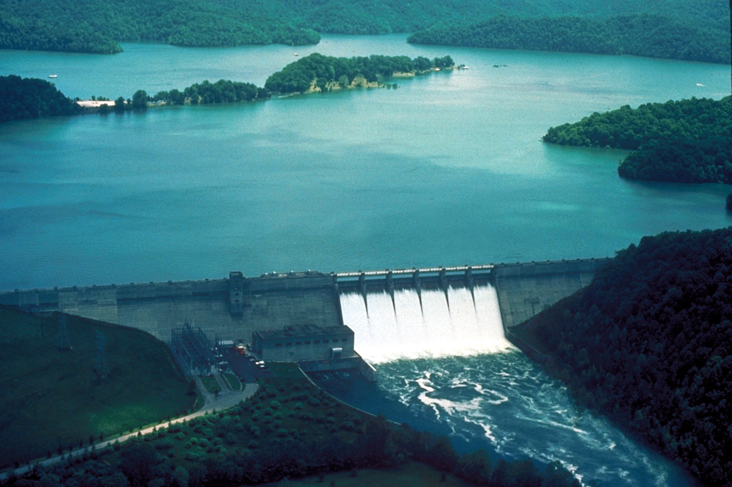
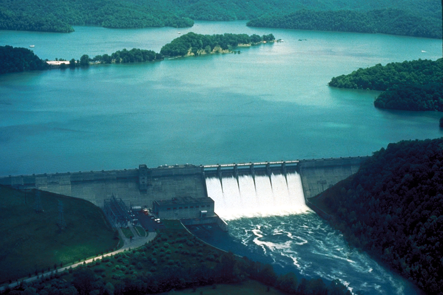
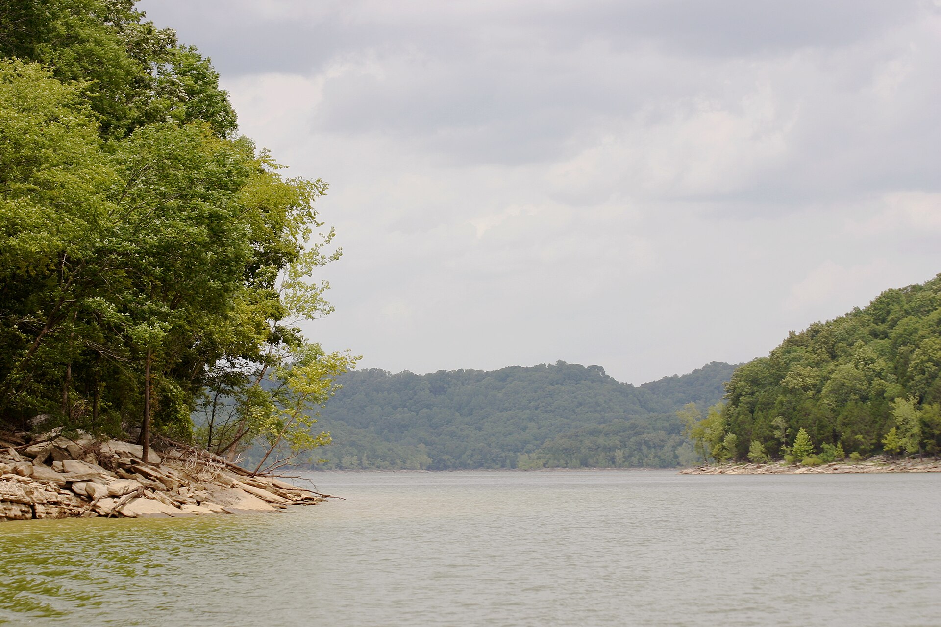
The clearest big lake in Middle Tennessee and the world-record smallmouth water; smallmouth average around 3 lb, largemouth around 2.5 lb, and Clay County holds the marina belt on the lake’s southern shore.

smallmouth (world-class)largemouthwalleyecatfish
reservoir · 13,920 ac on the Cumberland (Smith, Jackson, Clay) · US Army Corps of Engineers…

Cordell Hull Lake

One of the few Tennessee reservoirs with a self-sustaining sauger population, and spring electrofishing surveys regularly turn up largemouth over 5 lb; winter drawdown is only 5 ft, unusually shallow.

largemouthsaugercrappiestriped bass
river/tailwater · flows out of Dale Hollow Dam into the Cumberland at Celina · USACE

Obey River

The Dale Hollow tailwater is a genuine trout fishery stocked with all three species, and it joins the Cumberland right at Celina, which is why one small town sits on trout water, sauger water and smallmouth water at once.

brookbrown and rainbow trout below the dam; smallmouth and catfish lower down
river · runs through Celina · USACE

Cumberland River

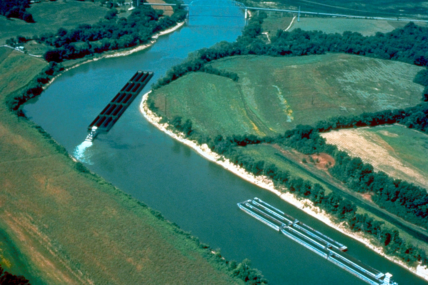
The Butler’s Landing and Donaldson Park ramps put you on the river between two reservoirs.

catfishsaugerstriped basssmallmouth

The ones nobody writes about

Small and out-of-the-way water in Clay County

County lakes, park ponds, creeks and river stretches in Clay County that never make a best-of list. Several of them fish better than the famous water on a busy weekend.

river stretch

Obey River Recreation Area

Launch ramp, shoreline access and campground on the Obey, the standard tailwater access.

troutsmallmouth
tailwater stretch

Dale Hollow Dam Recreation Area, Obey River

A named TWRA trout stocking point for all three species at Celina; boat ramp with fishing pier, restrooms, canoe landing and ADA provision.

brookbrownrainbow trout
river stretch

Moody Boat Ramp, Obey River

Single-lane ramp with a fishing pier and restrooms; quieter than the dam access.

troutsmallmouth
river stretch

Donaldson Park, Celina

Town park on the Obey/Cumberland confluence at Celina with a ramp and canoe landing.

catfishsaugersmallmouth
river stretch

Butler’s Landing

On the Cumberland about a mile into Clay County off Hwy 53; two adjacent ramps, one ADA.

catfishsauger
lake embayment

Pleasant Grove Day Use Area and Recreation Area

Two adjacent USACE ramps with restrooms and ADA provision on Dale Hollow.

smallmouthlargemouth
lake embayment

Lillydale

Campground and two-lane ramp on Dale Hollow, fee site.

smallmouthlargemouth
lake embayment

Willow Grove

Campground ramp, two lanes, fee site.

smallmouthlargemouth

No boat, or your own boat

Bank fishing and launching in Clay County

Fishing from the bank in Clay County

Dale Hollow Dam Boat Ramp fishing pier and the Obey River shoreline below the dam; Moody Boat Ramp pier; Obey River Recreation Area shoreline; Donaldson Park in Celina; Lilydale’s fishing pier; Horse Creek Resort and Cedar Hill Marina piers; Butler’s Landing on the Cumberland. The tailwater immediately below Dale Hollow Dam is the best bank trout fishing in the county.

Getting a boat on the water in Clay County

Eleven public ramps and seven commercial marinas, one of the densest marina concentrations in Tennessee. Full-service marinas with bait, fuel and rental fleets: Cedar Hill, Dale Hollow, Holly Creek, Horse Creek, Livingston, Mitchell Creek and Willow Grove.

Dale Hollow is deep, clear, highland-reservoir water with no general no-wake restriction and heavy houseboat traffic in summer. The Obey below the dam is canoe and drift water and can rise fast once generation starts, check USACE schedules. Several ramps carry a use fee.

Two different trips

Visiting Clay County versus fishing it like a local

Where visitors get pointed in Clay County

Dale Hollow Lake, the headline draw, marketed for its clarity and its smallmouth; Dale Hollow Dam and the Obey River tailwater; the Dale Hollow National Fish Hatchery; Celina as the lake’s Tennessee gateway town; Cordell Hull Lake and the Cumberland River; Standing Stone State Park just over the Overton line.

Where Clay County locals actually go

Moody Boat Ramp on the Obey, a single-lane USACE ramp with a pier that sits in the shadow of the far busier dam access. Butler’s Landing on the Cumberland, a mile into the county off Hwy 53, which most Dale Hollow visitors drive straight past. Donaldson Park in Celina itself.

Pleasant Grove Day Use Area, distinct from the adjacent recreation area and much quieter. The Cordell Hull side of the county generally, nearly all attention goes to Dale Hollow.

Rules and record fish

Limits and records for Clay County water

Creel and length limits in Clay County

Dale Hollow, smallmouth 2/day with a 16–21″ protected length range (one under 16″ and one over 21″ permitted); largemouth 15″ min; black bass 5/day combined with only two smallmouth; a maximum of four rods per angler, which is an unusual and easily missed rule. Cordell Hull, statewide reservoir rules apply for most species; its sauger population is self-sustaining.

Obey River below Dale Hollow Dam is managed trout water, check current tailwater creel and length rules before publishing specifics, as the Obey is not covered by the Caney Fork’s distinctive brown trout rule. Several USACE ramps and recreation areas charge a day-use or launch fee.

State record fish from Clay County water

State record striped bass, 65 lb 6 oz, Ralph Dallas, 1 May 2000, Cordell Hull Reservoir. Cordell Hull spans Smith, Jackson and Clay counties and TWRA’s Old Hickory page describes the fish as caught just upstream of Cordell Hull Dam, which would place it in Smith County, and the two TWRA pages disagree with each other.

The world-record smallmouth, 11 lb 15 oz, D.L. Hayes, 9 July 1955, is credited to Dale Hollow and listed as the Tennessee state record, but the fish was caught on the Kentucky side of the lake.

13 public boat launches in Clay County, counted from TWRA’s own access database.

Questions people actually ask

Clay County fishing questions

Where can I fish from the bank in Clay County?

Dale Hollow Dam Boat Ramp fishing pier and the Obey River shoreline below the dam. Also moody boat ramp pier, and obey river recreation area shoreline. Clay County has 6 public fishing piers listed in TWRA’s access database.

How many public boat ramps are in Clay County?

TWRA’s access database lists 13 boat launches in Clay County, plus 12 marinas. Most of them are on Dale Hollow Lake. Every one is listed further up this page with its owner and lane count.

Do I need a fishing license to fish in Clay County?

Yes. Anyone 13 and over needs a Tennessee fishing license, and there is no license required for ages 12 and under. A resident annual combination hunt and fish license is $33, a resident one-day all-species license is $11, and a non-resident three-day all-species license is $40. Tennessee has no non-resident one-day license. Buy online at gooutdoorstennessee.com, from a county clerk or from a licensed agent. Licenses are digital, nothing arrives in the post.

What fish can you catch in Clay County?

The main species across Clay County water are largemouth bass, smallmouth bass, crappie, striped bass, walleye, sauger, catfish and rainbow trout. Each water body on the fishing spots page lists what it is actually known for, which is not always the same thing.

Does my Tennessee license cover trout in Clay County?

Not automatically. The $33 resident combination hunt and fish license does not cover trout, and neither does the county-of-residence license or the cheaper no-trout short-term options. Those need the $21 annual trout supplemental added on. The Sportsman licenses and every non-resident all-species license already include trout. This matters in Clay County, because there is trout water here.

What are the creel limits in Clay County?

Dale Hollow, smallmouth 2/day with a 16–21″ protected length range (one under 16″ and one over 21″ permitted); largemouth 15″ min; black bass 5/day combined with only two smallmouth; a maximum of four rods per angler, which is an unusual and easily missed rule. Cordell Hull, statewide reservoir rules apply for most species; its sauger population is self-sustaining Obey River below Dale Hollow Dam is managed trout water, check current tailwater creel and length rules before publishing specifics, as the Obey is not covered by the Caney Fork’s distinctive brown trout rule Always check the current TWRA guide before you keep anything, because water-specific exceptions change.

Where can I buy bait and tackle in Clay County?

Bait onsite, per TWRA’s access database, at Cedar Hill Marina and Resort, Dale Hollow Marina, Holly Creek Dock/Marina, Horse Creek Resort/Marina, Livingston Marina, Mitchell Creek Marina and Willow Grove Dock & Resort, seven marina stores, all at Celina or Allons. Boat rentals at all seven. Clay County Chamber of Commerce, (931) 869-9001, for guide referrals. No standalone walk-in tackle shop verified in Celina by name and phone. Nearest big-box: no Walmart verified in Celina. There is a fuller list on the Clay County gear page, including anywhere renting boats or kayaks and the nearest big-box store.

Where do locals fish in Clay County?

Moody Boat Ramp on the Obey, a single-lane USACE ramp with a pier that sits in the shadow of the far busier dam access. Butler’s Landing on the Cumberland, a mile into the county off Hwy 53, which most Dale Hollow visitors drive straight past. Donaldson Park in Celina itself. Pleasant Grove Day Use Area, distinct from the adjacent recreation area and much quieter. The Cordell Hull side of the county generally, nearly all attention goes to Dale Hollow.

Clay County water holds largemouth bass, smallmouth bass, crappie, striped bass.

Statewide limits: 5 black bass, 15 crappie at 10 inches, 2 stripers at 15 inches, 7 trout.

About this list

Where the Clay County access list comes from

The 25 access points above come from the Tennessee Wildlife Resources Agency’s public access database, which is why each one names the agency that owns or manages it. A state or TVA ramp is usually free. A Corps of Engineers site, a state park ramp or a marina often is not.

The waters, species and local notes are researched separately, county by county, against TWRA’s own reservoir pages, TVA, the US Army Corps of Engineers and Tennessee State Parks.

Ramps close for repairs, gravel roads wash out and regulations change. Treat anything here as a starting point and call ahead if you are driving a long way for it.

By town instead

Towns near Clay County

These pages measure from the middle of town rather than the county line, which is usually the number you actually care about.

6 public fishing piers in Clay County, no boat needed.

Keep going

More Clay County water, and who fishes it

Every guide and charter on this site is listed by the water they run, so you can call the captain direct. Licences, limits and the state record list are one click away too.

Weather alerts, power outages and road closures in Clay County right now: Clay County conditions.