95 Counties · 1,002 Public Access Points · 78 Lakes and RiversTennessee state record fish

East Tennessee · County seat Blountville (Tennessee’s only unincorporated county seat)

Fishing in Sullivan County, Tennessee

South Holston Reservoir, South Holston River (tailwater), Boone Lake. Where to launch, where to fish from the bank, and where to buy what you forgot.

Every public access point

Fishing access in Sullivan County

24 public access points in Sullivan County: 14 boat launches, 1 fishing pier, 4 designated fishing sites and 6 marinas. Each one opens its own page with written directions, coordinates and a link straight to Google Maps.

Tap a pin for the spot page and directions. Open the full Tennessee fishing map.

Boone Lake 7 in Sullivan County

Patrick Henry Lake 1 in Sullivan County

South Fork Holston River 10 in Sullivan County

Free2.5 out of 5facilitiesBoat Launch · TWRABig Springs AccessBig Springs Rd, Bluff City, TN1 ramp, 1 laneDirections and detail →36.49750, -82.16165Free2.5 out of 5facilitiesBoat Launch · CityBluff City Park1 ramp, 1 lanecanoe / kayak landingaccessible parkingDirections and detail →36.47616, -82.26406Free2.5 out of 5facilitiesBoat Launch · CityCity of Kingsport AccessHwy 11W to Netherland Inn Rd1 ramp, 1 lanecanoe / kayak landingaccessible parkingDirections and detail →36.55038, -82.61004Free2.5 out of 5facilitiesBoat Launch · TVAEmmett Bridge Access1 ramp, 1 lanecanoe / kayak landingDirections and detail →36.52734, -82.11313Free2.5 out of 5facilitiesBoat Launch · TWRAJ. Forrest Thomas Access Area1315 Dry Branch Rd, Bluff City, TN 376181 ramp, 1 laneDirections and detail →36.46362, -82.22448Free2 out of 5facilitiesBoat Launch · TVASmith ShoalsBeulah Church Drive, Kingsport, TN1 ramp, 1 lanecanoe / kayak landingDirections and detail →36.45996, -82.45968Free2 out of 5facilitiesFishing Site · TVAFt. Patrick Henry DamI-81 to Hwy. 36 (Fort Henry Drive) to Wesley Rd.canoe / kayak landingDirections and detail →36.50143, -82.51441Free2.5 out of 5facilitiesFishing Site · TVAOsceola IslandUS 421 to Emmett Road to Holston View Dam Roadrestroomsaccessible parkingDirections and detail →36.52371, -82.10981Free1.5 out of 5facilitiesFishing Site · TVASouth Holston DamUS 421 to Emmett Road to Holston View Dam RoadDirections and detail →36.52211, -82.09774Free1.5 out of 5facilitiesFishing Site · TVATVA Walk-in AccessUS 421 to Hwy. 44 to River Bend RoadDirections and detail →36.51067, -82.11471

South Holston 1 in Sullivan County

South Holston Lake 4 in Sullivan County

Ft Patrick Henry Reservoir 1 in Sullivan County

What to bring

What to bring fishing in Sullivan County

Three picks from the largemouth bass checklist that work for the fish here. Affiliate links: buying through them pays this site a small commission at no extra cost to you.

RodUgly Stik GX2 7 ft medium-heavy casting rodStiff enough to set a hook in grass, tough enough to live in a truck bed.Shop on Amazon →Why it is on the list
ReelAbu Garcia Black Max baitcasting reelAn inexpensive baitcaster that casts cleanly once the brakes are set.Shop on Amazon →Why it is on the list
Soft plasticZoom Trick WormThe Tennessee standard on a Texas rig or weightless along docks and grass edges.Shop on Amazon →Why it is on the list

Spending more? The bigger purchases, compared side by side:

Sullivan County at a glance

Sullivan County boat ramps and fishing access

Sullivan County has 24 public fishing access points: 14 boat ramps, 1 fishing pier and 6 marinas, on 6 lakes, rivers and creeks.

14boat ramps
1fishing pier
6marinas
6lakes, rivers and creeks

The big water in Sullivan

Main fishing waters in Sullivan County

What each of these is actually known for, and what you can expect to catch.

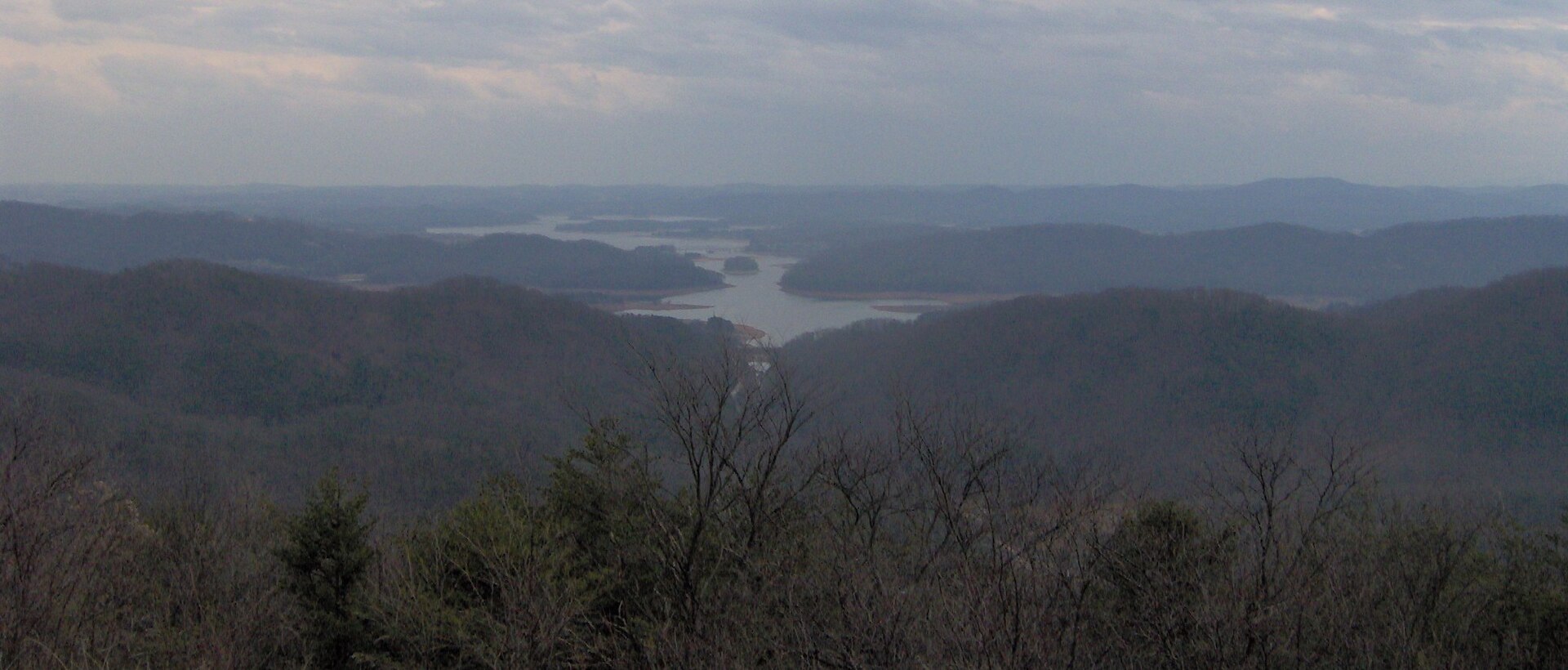
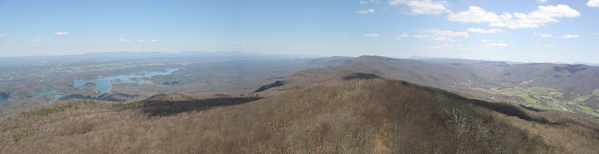
TVA storage impoundment · 7,580 ac, with about 1,250 ac extending into Virginia · TVA

South Holston Lake

Winter drawdown runs up to 40 ft and the water is exceptionally clear and low-fertility, so smallmouth grow large and in excellent condition; much of the shoreline is Cherokee National Forest, which makes bank access unusually good for a TVA lake.

smallmouthlargemouthwalleyecrappie
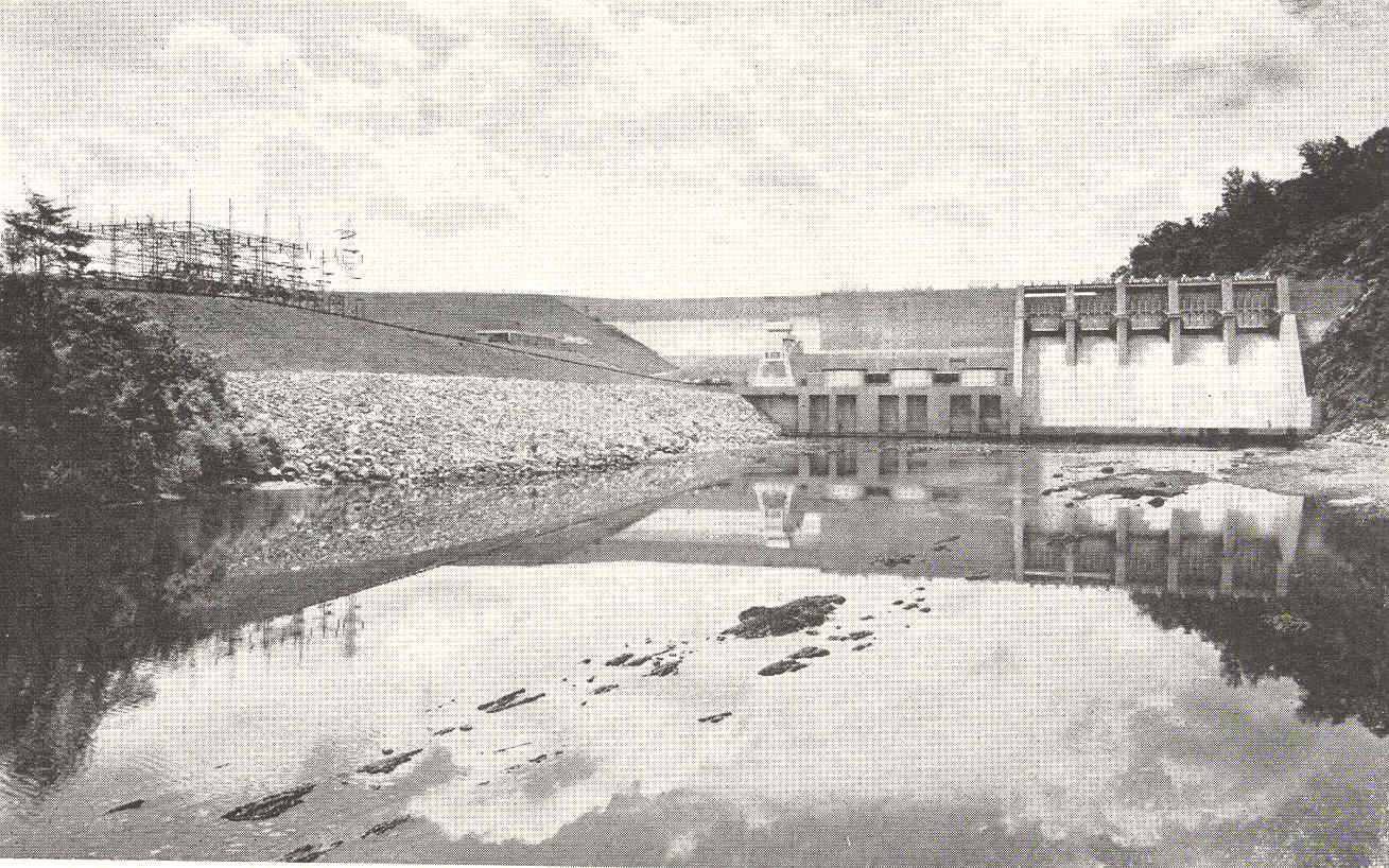
trout tailwater · S. Holston Dam downstream to Boone Reservoir · TVA generation, TWRA fishery

South Holston River (tailwater)

The signature is the sulphur hatch and a self-sustaining brown trout population; the weir dam below the main dam re-aerates and re-regulates flow, and that section becomes unwadeable the moment TVA generates.

wild brown troutrainbow trout
TVA impoundment on the South Fork Holston and Watauga · 4,400–4,520 ac · TVA

Boone Lake

Shoreline is heavily privatized so public land is scarce; TWRA names Davis Dock and Devault Bridge for topwater stripers, and clay points at 20–30 ft in winter.

largemouthsmallmouthspotted bassstriped and hybrid bass
TVA impoundment, Kingsport · 895 ac · TVA

Fort Patrick Henry Reservoir

Small, cold and short, it fishes more like a wide river than a lake and it is legally trout water, the reservoir carries a 16–22″ PLR on rainbow and brown trout.

largemouth (no length limit)smallmouthspotted basscrappie
river

Holston River (main stem, from the Kingsport confluence downstream)

The North and South Forks join in Kingsport to form the Holston proper; the smallmouth here carry a 13–17″ protected range.

smallmouthredbreast sunfishgizzard shadrock bass
river forming the Hawkins County line

North Fork Holston River

Wadeable smallmouth water with the same 13–17″ PLR.

smallmouthrock bass

The ones nobody writes about

Small and out-of-the-way water in Sullivan County

County lakes, park ponds, creeks and river stretches in Sullivan County that never make a best-of list. Several of them fish better than the famous water on a busy weekend.

Kingsport Reservoir (GNIS), municipal water-supply reservoir.

Edinburgh Park, Kingsport, two stocked ponds.

No boat, or your own boat

Bank fishing and launching in Sullivan County

Fishing from the bank in Sullivan County

Osceola Island Recreation Area and the weir dam trails; Bouton Trail trailhead (0.33-mile walk to the river); Old Railroad Bridge on the South Holston; Emmett Bridge; Hickory Tree Bridge; Boatyard Riverfront Park piers, Kingsport; Kingsport Greenbelt piers and ramps; Warriors’ Path State Park fishing pier and shoreline; Steele Creek Park Lake shoreline; Bays Mountain dam (age-restricted); South Holston Reservoir shoreline inside Cherokee National Forest (Flint Mill, Big Creek, Painter Creek areas).

Getting a boat on the water in Sullivan County

Boone Lake Marina, 452 Sportsman Dock Rd, Piney Flats, (423) 391-7283. The Marina at Warriors’ Path State Park, slip rentals year-round plus kayak, canoe and pedal boat rentals. Steele Creek Park paddle boat rentals, Bristol.

Laurel Marina, 195 Shady Ford Rd, Bristol, (423) 878-5656. CBK Watersports, Bristol/Kingsport, (423) 212-0100. Shadrack Watersports, Bristol, (423) 652-0120. South Holston tailwater is a classic drift-boat float, Weir Dam or Emmett Bridge down to Bluff City.

The weir section is unwadeable and hazardous during generation, call TVA at 1-800-238-2264.

Two different trips

Visiting Sullivan County versus fishing it like a local

Where visitors get pointed in Sullivan County

Bristol Motor Speedway and the State Street Tennessee/Virginia line; Birthplace of Country Music Museum, Bristol; Bays Mountain Park and Planetarium, Kingsport; Warriors’ Path State Park; Steele Creek Park; South Holston Dam and Osceola Island weir; Rocky Mount State Historic Site; Appalachian Trail and Cherokee National Forest on the South Holston’s southern shore.

Where Sullivan County locals actually go

Osceola Island weir-dam wade spots reached from the walking trails rather than from a boat; the Bouton Trail walk-in; Allandale Mansion’s two ponds (free, in-town, stocked, and almost nobody outside Kingsport fishes them); Edinburgh Park ponds; Bays Mountain dam if you qualify by age; the Fort Patrick Henry tailwater inside Warriors’ Path, which is legally trout water in the middle of a city park; the Virginia arm of South Holston above Alvarado; North Fork Holston road crossings on the Hawkins line.

Rules and record fish

Limits and records for Sullivan County water

Creel and length limits in Sullivan County

– South Holston River (S. Holston Dam to Boone Dam, including Boone Reservoir upstream to the Hwy 11E / DeVault Bridge on the Watauga arm): 16–22″ protected length range on all trout, 7-trout creel, only one over 22″., Closed to all fishing 1 Nov–31 Jan in two defined sections: Hickory Tree Bridge upstream to the Bottom Creek confluence, and the downstream point of Boy’s Island (first island below Weaver Pike Bridge) upstream to the top of the first island above Webb Road Bridge.

The closure applies to catch-and-release anglers too., Fort Patrick Henry Reservoir: 16–22″ PLR on rainbow and brown trout, 7-trout creel. Largemouth no length limit, smallmouth 15″ min, spotted bass 15/day no length limit, walleye 5/day 18″ min., South Holston Reservoir: largemouth no length limit, smallmouth 15″ min, spotted bass no creel or length limit, walleye 5/day 18″ min, catfish 20/day with one over 34″, bluegill 50/day., Boone Reservoir: black bass 5/day with 15″ min on largemouth and smallmouth, spotted bass 15/day no length limit, striped bass 1/day at 36″ min, trout 7/day with the 16–22″ PLR., South Fork Holston, North Fork Holston and Holston River (stream sections): smallmouth 13–17″ PLR, only one over 17″., Virginia reciprocity: Tennessee residents may buy an annual South Holston Reservoir License covering the Virginia impounded water below 1,730 ft elevation, upstream to the Route 710 bridge at Alvarado, VA., Advisories: avoid eating catfish and carp from Boone (PCBs, chlordane); precautionary mercury advisory on South Holston largemouth for children and pregnant/nursing women., TWRA stocks the South Holston tailwater Mar–Sep, Fort Patrick Henry tailwater Mar, Apr and Dec

State record fish from Sullivan County water

– Northern pike, 24 lb 8 oz, South Holston Reservoir, Frank Childers, 28 March 1995., Quillback carpsucker, 6 lb 5 oz, South Holston Reservoir, Daniel Taylor, 10 February 2019., Cutthroat trout, 6 lb 9 oz, Fort Patrick Henry, Charles Donald Fulton, 28 June 2024., Black redhorse, 3 lb 1 oz, South Holston River, Roy Hawk, 16 February 2009., Northern hogsucker, 2 lb 9 oz, South Holston River, Roy Hawk, 16 February 2009., Redbreast sunfish, 1 lb 5 oz, Holston River, R. W. Gillespie, 22 June 1974 (river spans several counties; not certainly Sullivan)., Gizzard shad, 3 lb 3 oz, Holston River, Preston H. Taylor III, 13 December 2008 (same caveat).

14 public boat launches in Sullivan County, counted from TWRA’s own access database.

Questions people actually ask

Sullivan County fishing questions

Where can I fish from the bank in Sullivan County?

Osceola Island Recreation Area and the weir dam trails. Also bouton trail trailhead (0.33-mile walk to the river), and old railroad bridge on the south holston. Sullivan County has 1 public fishing pier listed in TWRA’s access database.

How many public boat ramps are in Sullivan County?

TWRA’s access database lists 14 boat launches in Sullivan County, plus 6 marinas. Most of them are on South Fork Holston River. Every one is listed further up this page with its owner and lane count.

Do I need a fishing license to fish in Sullivan County?

Yes. Anyone 13 and over needs a Tennessee fishing license, and there is no license required for ages 12 and under. A resident annual combination hunt and fish license is $33, a resident one-day all-species license is $11, and a non-resident three-day all-species license is $40. Tennessee has no non-resident one-day license. Buy online at gooutdoorstennessee.com, from a county clerk or from a licensed agent. Licenses are digital, nothing arrives in the post.

What fish can you catch in Sullivan County?

The main species across Sullivan County water are largemouth bass, smallmouth bass, spotted bass, crappie, sunfish, rock bass, walleye, northern pike and blue catfish. Each water body on the fishing spots page lists what it is actually known for, which is not always the same thing.

Does my Tennessee license cover trout in Sullivan County?

Not automatically. The $33 resident combination hunt and fish license does not cover trout, and neither does the county-of-residence license or the cheaper no-trout short-term options. Those need the $21 annual trout supplemental added on. The Sportsman licenses and every non-resident all-species license already include trout. There is no designated trout water in Sullivan County, but it is worth knowing before you drive to a tailwater elsewhere in the state.

What are the creel limits in Sullivan County?

– South Holston River (S. Holston Dam to Boone Dam, including Boone Reservoir upstream to the Hwy 11E / DeVault Bridge on the Watauga arm): 16–22″ protected length range on all trout, 7-trout creel, only one over 22″, Closed to all fishing 1 Nov–31 Jan in two defined sections: Hickory Tree Bridge upstream to the Bottom Creek confluence, and the downstream point of Boy’s Island (first island below Weaver Pike Bridge) upstream to the top of the first island above Webb Road Bridge Always check the current TWRA guide before you keep anything, because water-specific exceptions change.

Where can I buy bait and tackle in Sullivan County?

– South Holston River Fly Shop, 608 Emmett Rd, Bristol, (423) 878-2822. Full-service fly shop, wade and float guiding., The Fly Box, 500 Hickory Tree Rd, Bristol, (423) 573-5668. Guided tailwater and backcountry trips., Eastern Fly Outfitters, 6209 Bristol Hwy, Piney Flats, (423) 538-3007., The Fishin Hole, 409 Hillcrest Dr, Bluff City, (423) 391-7703 (second location: The Fishin Hole 2, 101 William J Pvt Dr, Bluff City)., Mel Brothers Tacklebox, 688 Pleasant Hill Rd, Blountville, (423) 574-2248. (Mel Brother Wholesale Bait, 3748 Highway 75, Kingsport, (423) 323-5579.), Wilson’s Bait & Tackle, 2723 Denton Valley Rd, Bristol, (276) 628-7546., Bass Pro Shops, 1 Bass Pro Dr, Bristol, (423) 990-5200. There is a fuller list on the Sullivan County gear page, including anywhere renting boats or kayaks and the nearest big-box store.

Where do locals fish in Sullivan County?

Osceola Island weir-dam wade spots reached from the walking trails rather than from a boat. the Bouton Trail walk-in. Allandale Mansion’s two ponds (free, in-town, stocked, and almost nobody outside Kingsport fishes them).

The water itself

Lakes and rivers in Sullivan County

Each of these has a page of its own covering the whole water, not just the Sullivan County end of it, with every public access point on it and what it holds.

Sullivan County water holds largemouth bass, smallmouth bass, spotted bass, crappie.

Statewide limits: 5 black bass, 15 crappie at 10 inches, 2 stripers at 15 inches, 7 trout.

About this list

Where the Sullivan County access list comes from

The 24 access points above come from the Tennessee Wildlife Resources Agency’s public access database, which is why each one names the agency that owns or manages it. A state or TVA ramp is usually free. A Corps of Engineers site, a state park ramp or a marina often is not.

The waters, species and local notes are researched separately, county by county, against TWRA’s own reservoir pages, TVA, the US Army Corps of Engineers and Tennessee State Parks.

Ramps close for repairs, gravel roads wash out and regulations change. Treat anything here as a starting point and call ahead if you are driving a long way for it.

By town instead

Towns near Sullivan County

These pages measure from the middle of town rather than the county line, which is usually the number you actually care about.

1 public fishing pier in Sullivan County, no boat needed.

Keep going

More Sullivan County water, and who fishes it

Every guide and charter on this site is listed by the water they run, so you can call the captain direct. Licences, limits and the state record list are one click away too.

Weather alerts, power outages and road closures in Sullivan County right now: Sullivan County conditions.