95 Counties · 1,002 Public Access Points · 78 Lakes and RiversTennessee state record fish

East Tennessee · County seat Rutledge

Fishing in Grainger County, Tennessee

Cherokee Lake, Norris Lake, Holston River (below Cherokee Dam). Where to launch, where to fish from the bank, and where to buy what you forgot.

Every public access point

Fishing access in Grainger County

31 public access points in Grainger County: 21 boat launches, 1 fishing pier, 4 designated fishing sites, 2 paddling accesses and 3 marinas. Each one opens its own page with written directions, coordinates and a link straight to Google Maps.

Tap a pin for the spot page and directions. Open the full Tennessee fishing map.

Cherokee Lake 22 in Grainger County

Launch fee3 out of 5facilitiesBoat Launch · Private LandCardinal Cove Resort, Inc.1 ramp, 1 lanecanoe / kayak landingrestroomsrentalsDirections and detail →36.26190, -83.41410Free2 out of 5facilitiesBoat Launch · TVACounty Line Road Access Area1351 County Line Rd, Mooresburg, TN 378111 ramp, 1 lanecanoe / kayak landingDirections and detail →36.31917, -83.27676Free2 out of 5facilitiesBoat Launch · TVAGerman Creek Access Area2955 Lakeshore Dr, Bean Station, TN 377081 rampcanoe / kayak landingDirections and detail →36.30807, -83.34582Launch fee4 out of 5facilitiesBoat Launch · Private LandGerman Creek Resort1 ramp, 1 lanecanoe / kayak landingrestroomsrentalsDirections and detail →36.30480, -83.34710Launch fee3.5 out of 5facilitiesBoat Launch · MarinaGilmore Dock, Inc.Turn onto Gilmore Dock Lane off HWY 374 (Lakeshore Rd), just West of Helton Rd1 ramp, 1 lanecanoe / kayak landingrestroomsrentalsDirections and detail →36.27020, -83.39370Free4 out of 5facilitiesBoat Launch · TVAGrainger County Park12586 Lakeshore Dr, Rutledge, TN 378611 ramp, 2 lanescanoe / kayak landingrestroomsDirections and detail →36.21340, -83.46780Launch fee4 out of 5facilitiesBoat Launch · TVAGreenlee Campground1 ramp, 1 lanecanoe / kayak landingrestroomsrentalsDirections and detail →36.23450, -83.43210Launch fee3.5 out of 5facilitiesBoat Launch · TVAGreenlee Campground May SpringsFollow HWY 375 (Lakeshore Rd) approx 5 miles from HWY 92, right on Wa-Ni Village Rd, right onto May Springs Rd1 ramp, 1 lanerestroomsrentalsDirections and detail →36.21510, -83.46300Free3 out of 5facilitiesBoat Launch · TVAHwy 25E #1301 US 25E, Bean Station, TN 377082 ramps, 2 lanescanoe / kayak landingDirections and detail →36.26805, -83.28510Launch fee3.5 out of 5facilitiesMarina · Private LandLakeside Marina1 ramp, 1 lanecanoe / kayak landingrestroomsrentalsDirections and detail →36.27150, -83.28190Free2.5 out of 5facilitiesBoat Launch · TVALambdin Branch10394 Lakeshore Dr, Rutledge, TN 378611 ramp, 1 lanecanoe / kayak landingDirections and detail →36.24070, -83.43700Free3 out of 5facilitiesBoat Launch · TVAOak Grove Access Area1536 Oak Grove Rd, Bean Station, TN 377081 ramp, 1 lanecanoe / kayak landingDirections and detail →36.30190, -83.32320Free2 out of 5facilitiesBoat Launch · TWRAOakland Hollow Access Area15061 Lakeshore Dr, Rutledge, TN 378611 ramp, 1 lanecanoe / kayak landingDirections and detail →36.17720, -83.48830Free2 out of 5facilitiesBoat Launch · TVARock Haven CreekRamp area1 ramp, More Than 3 lanesDirections and detail →36.32874, -83.37560Free3 out of 5facilitiesBoat Launch · TVATate SpringsHwy 11-W south toward Rutlegde; on left 1/2 mile from hwy 25-E1 ramp, 1 lanecanoe / kayak landingDirections and detail →36.33530, -83.34890Free2.5 out of 5facilitiesBoat Launch · TVATwin Churches499 Twin Church Rd, Bean Station, TN 377081 rampcanoe / kayak landingDirections and detail →36.27360, -83.37810Launch fee3 out of 5facilitiesBoat Launch · Private LandWA-NI Village Boat DockTurn onto Wa-Ni Village Road1 ramp, 1 lanecanoe / kayak landingrestroomsrentalsDirections and detail →36.22190, -83.45160Free2 out of 5facilitiesFishing SiteHwy 25 Fishing Pier1730 US 25E, Bean Station, TN 37708fishing pierDirections and detail →36.30324, -83.29186Fee not listed1 out of 5facilitiesMarinaCard’nal Cove ResortDirections and detail →36.26233, -83.41393Free2 out of 5facilitiesFishing Site · TWRACircle ParkTurn in Circle Park off Hwy 25-Ecanoe / kayak landingDirections and detail →36.29860, -83.29060Fee not listed1 out of 5facilitiesMarinaGerman Creek MarinaDirections and detail →36.30433, -83.34777Fee not listed1 out of 5facilitiesAttention · TVAMary’s ChapelMary’s Chapel Rd, Bean Station, TNDirections and detail →36.30478, -83.35559

Holston River 2 in Grainger County

Norris Lake 7 in Grainger County

What to bring

What to bring fishing in Grainger County

Three picks from the largemouth bass checklist that work for the fish here. Affiliate links: buying through them pays this site a small commission at no extra cost to you.

RodUgly Stik GX2 7 ft medium-heavy casting rodStiff enough to set a hook in grass, tough enough to live in a truck bed.Shop on Amazon →Why it is on the list
ReelAbu Garcia Black Max baitcasting reelAn inexpensive baitcaster that casts cleanly once the brakes are set.Shop on Amazon →Why it is on the list
Soft plasticZoom Trick WormThe Tennessee standard on a Texas rig or weightless along docks and grass edges.Shop on Amazon →Why it is on the list

Spending more? The bigger purchases, compared side by side:

Grainger County at a glance

Grainger County boat ramps and fishing access

Grainger County has 31 public fishing access points: 21 boat ramps, 1 fishing pier, 3 marinas and 2 kayak launches, on 3 lakes, rivers and creeks.

21boat ramps
1fishing pier
3marinas
2kayak launches
3lakes, rivers and creeks

The big water in Grainger

Main fishing waters in Grainger County

What each of these is actually known for, and what you can expect to catch.

reservoir · 30,300 acres with 393 miles of shoreline · Tennessee Valley Authority, fishery…

Cherokee Lake

Grainger County holds the largest share of Cherokee’s shoreline and the most ramps of any county on the lake

largemouthsmallmouthstriped bassCherokee (hybrid) bass
reservoir · 34,200 acres with 800 miles of shoreline, TVA’s first dam, completed 1936 ·…

Norris Lake

Grainger County fronts the lake’s southern Clinch arm

smallmouth bassstriped basswalleyelargemouth
tailwater · TVA operates the dam, TWRA manages the fishery

Holston River (below Cherokee Dam)

Stocked November through April only, because the river warms in summer, a notably narrow window

rainbow and brown troutsmallmouth bass
river · TVA/TWRA

Clinch River

Forms the county’s northern boundary and is popular for canoeing and kayaking.

smallmouthrock basssunfishcatfish

What it looks like

Grainger County water

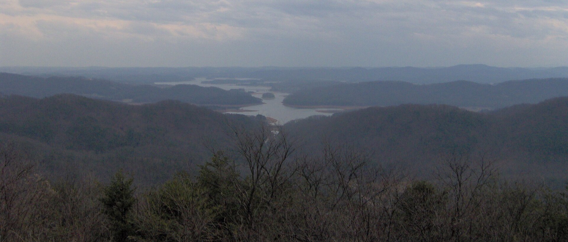
Photographs of the water this page covers. Every picture opens that water’s own page. Drag or swipe to see the rest.

The ones nobody writes about

Small and out-of-the-way water in Grainger County

County lakes, park ponds, creeks and river stretches in Grainger County that never make a best-of list. Several of them fish better than the famous water on a busy weekend.

creek

Richland Creek (Grainger County)

A Holston River branch near Rutledge, note this is one of at least five Tennessee creeks called Richland Creek and is not the Giles County one.

sunfishrock basssmallmouth
creek arm of Norris

Hogskin Creek

Named on the Norris access listing at the Black Fox Access Area.

crappiesmallmouthsunfish
creek arm of Cherokee

German Creek embayment

Has both a public bridge ramp and a marina.

crappielargemouthbluegill
creek arms of Cherokee

May Springs and Oakland Hollow embayments

Quiet arms with their own access.

crappiebass
county park on Cherokee

Grainger County Park waters

Kayak launch point and bank access.

basscrappiebream

No boat, or your own boat

Bank fishing and launching in Grainger County

Fishing from the bank in Grainger County

Grainger County Park on Cherokee Lake (county park with kayak launch and shoreline); the Olen R. Marshall Bridge access at US-25E; the Oak Grove and Twin Churches access areas; the US-11W boat launch shoreline at Bean Station; Holston River bank at the few public points below Cherokee Dam, access here is genuinely limited and should be stated as such; Clinch River road crossings on the county’s northern boundary

Getting a boat on the water in Grainger County

Grainger County is unusually well provided with marinas: Gilmore Boat Dock, Greenlee Campground & Marine, Greenlee of May Springs and Wa-Ni Village Resort around Rutledge, and Huff’s German Creek Marina and Lakeside Marina around Bean Station. Cherokee is a large open reservoir and gets rough in wind; the creek arms are the sheltered water.

Note the seasonal closure: no fishing by boat is permitted in the described zone near Cherokee Dam from 1 July to 15 September. Norris Lake’s Grainger County ramps sit on the Clinch arm and the lake’s 45-foot annual drawdown means ramp usability changes dramatically through the year, always check the current lake level before towing a boat there.

The Clinch River is popular canoe and kayak water. The Holston below Cherokee Dam is primarily a float fishery, with three standard runs: Dam to Tampico, Tampico to Indian Cave, and Indian Cave to Nances Ferry.

Two different trips

Visiting Grainger County versus fishing it like a local

Where visitors get pointed in Grainger County

Cherokee Lake and the Bean Station marina cluster; Norris Lake’s southern shore; the Holston River tailwater for guided trout floats; Grainger County Park; the Clinch River for paddling; Grainger County’s tomato festival in July, which is the county’s biggest visitor draw and fills lodging

Where Grainger County locals actually go

Black Fox Access Area on Norris Lake at the Hogskin Creek arm, a genuinely quiet Norris access on the Grainger side, far from the busy Campbell and Union County marinas. Williams Creek on Norris. The May Springs and Oakland Hollow arms of Cherokee.

Twin Churches access, which is the least-used of the Bean Station public ramps. The Clinch River crossings on the far north county line for smallmouth.

Rules and record fish

Limits and records for Grainger County water

Creel and length limits in Grainger County

Cherokee Lake’s smallmouth rule is split by season and is easy to get wrong: 18-inch minimum at 1 per day from 1 June to 15 October, then a 15-inch minimum at 5 per day from 16 October to 31 May. Largemouth 15-inch minimum year-round. Black bass 5 per day combined. Crappie 15 per day at 10 inches. Striped and Cherokee bass 2 per day at 15 inches. Walleye and saugeye 10 per day at 15 inches.

Paddlefish are the distinctive one: 1 per day and snagging is permitted only from 1 to 15 April. A closed fishing zone near Cherokee Dam bars all boat fishing for any species from 1 July through 15 September.

Norris Lake has its own smallmouth rule, also split: 1 per day at an 18-inch minimum from 1 June to 15 October, and 5 per day at a 15-inch minimum from 16 October to 31 May; largemouth 5 per day at 14 inches; stripers 2 per day April–October and 1 per day November–March; crappie 10 per day at 10 inches. The Holston tailwater carries trout regulations and requires a trout licence.

State record fish from Grainger County water

Tennessee state record paddlefish, 149 lb, Henry Dyer, 13 Apr 2023, Cherokee Lake (county of capture not specified by TWRA; Cherokee spans Grainger, Hamblen, Jefferson and Hawkins). Tennessee state record redbreast sunfish, 1 lb 5 oz, 1974, Holston River. Tennessee state record gizzard shad, 3 lb 3 oz, 2008, Holston River.

21 public boat launches in Grainger County, counted from TWRA’s own access database.

Questions people actually ask

Grainger County fishing questions

Where can I fish from the bank in Grainger County?

Grainger County Park on Cherokee Lake (county park with kayak launch and shoreline). Also the olen r. marshall bridge access at us-25e, and the oak grove and twin churches access areas. Grainger County has 1 public fishing pier listed in TWRA’s access database.

How many public boat ramps are in Grainger County?

TWRA’s access database lists 21 boat launches in Grainger County, plus 3 marinas. Most of them are on Cherokee Lake. Every one is listed further up this page with its owner and lane count.

Do I need a fishing license to fish in Grainger County?

Yes. Anyone 13 and over needs a Tennessee fishing license, and there is no license required for ages 12 and under. A resident annual combination hunt and fish license is $33, a resident one-day all-species license is $11, and a non-resident three-day all-species license is $40. Tennessee has no non-resident one-day license. Buy online at gooutdoorstennessee.com, from a county clerk or from a licensed agent. Licenses are digital, nothing arrives in the post.

What fish can you catch in Grainger County?

The main species across Grainger County water are largemouth bass, smallmouth bass, crappie, bluegill, rock bass, striped bass, white bass, walleye and saugeye. Each water body on the fishing spots page lists what it is actually known for, which is not always the same thing.

Does my Tennessee license cover trout in Grainger County?

Not automatically. The $33 resident combination hunt and fish license does not cover trout, and neither does the county-of-residence license or the cheaper no-trout short-term options. Those need the $21 annual trout supplemental added on. The Sportsman licenses and every non-resident all-species license already include trout. There is no designated trout water in Grainger County, but it is worth knowing before you drive to a tailwater elsewhere in the state.

What are the creel limits in Grainger County?

Cherokee Lake’s smallmouth rule is split by season and is easy to get wrong: 18-inch minimum at 1 per day from 1 June to 15 October, then a 15-inch minimum at 5 per day from 16 October to 31 May. Largemouth 15-inch minimum year-round Black bass 5 per day combined Always check the current TWRA guide before you keep anything, because water-specific exceptions change.

Where can I buy bait and tackle in Grainger County?

The marina cluster is the county’s gear infrastructure: Gilmore Boat Dock, Rutledge, 865-767-2177. There is a fuller list on the Grainger County gear page, including anywhere renting boats or kayaks and the nearest big-box store.

Where do locals fish in Grainger County?

Black Fox Access Area on Norris Lake at the Hogskin Creek arm, a genuinely quiet Norris access on the Grainger side, far from the busy Campbell and Union County marinas. Williams Creek on Norris. The May Springs and Oakland Hollow arms of Cherokee. Twin Churches access, which is the least-used of the Bean Station public ramps. The Clinch River crossings on the far north county line for smallmouth.

The water itself

Lakes and rivers in Grainger County

Each of these has a page of its own covering the whole water, not just the Grainger County end of it, with every public access point on it and what it holds.

Grainger County water holds largemouth bass, smallmouth bass, crappie, bluegill.

Statewide limits: 5 black bass, 15 crappie at 10 inches, 2 stripers at 15 inches, 7 trout.

About this list

Where the Grainger County access list comes from

The 31 access points above come from the Tennessee Wildlife Resources Agency’s public access database, which is why each one names the agency that owns or manages it. A state or TVA ramp is usually free. A Corps of Engineers site, a state park ramp or a marina often is not.

The waters, species and local notes are researched separately, county by county, against TWRA’s own reservoir pages, TVA, the US Army Corps of Engineers and Tennessee State Parks.

Ramps close for repairs, gravel roads wash out and regulations change. Treat anything here as a starting point and call ahead if you are driving a long way for it.

1 public fishing pier in Grainger County, no boat needed.

Keep going

More Grainger County water, and who fishes it

Every guide and charter on this site is listed by the water they run, so you can call the captain direct. Licences, limits and the state record list are one click away too.

Weather alerts, power outages and road closures in Grainger County right now: Grainger County conditions.